Search
Now showing items 1-10 of 71
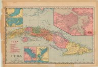
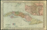
Cuba
(Rand McNally and Company, 1898)
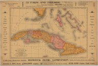
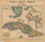
Cuba
(McConnell School Supply Company, 1898)
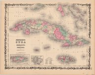
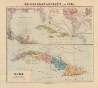
Cuba, Jamaica and Porto Rico
(New York : J.H. Colton & Co., 1856., 1856)
Shows political boundaries, cities, natural features, and railroads in Cuba
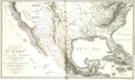
Carte du Mexique et pays limitrophes situés au nord et à l'est
(F. Schoell, 1811)
An uncolored map of Mexico, the United States and the West Indies.

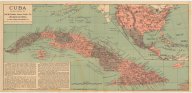
Map of Cuba: its provinces, railroads, cities, towns, harbors, bays, etc. also southern Florida and neighboring islands of the West Indies
(Mast, Crowell & Kirkpatrick Publishers, 1897)
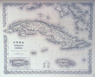
Map of Cuba
(Colton, Ohman & Co., 1898)