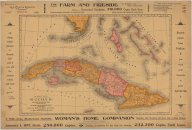
Map of Cuba: its provinces, railroads, cities, towns, harbors, bays, etc. also southern Florida and neighboring islands of the West Indies
Description
Relief shown by hachures. Depths shown by bathymetric isolines.1 map (2 views showing front and back)
Collections
Citation
(1897). Map of Cuba: its provinces, railroads, cities, towns, harbors, bays, etc. also southern Florida and neighboring islands of the West Indies. Mast, Crowell & Kirkpatrick Publishers. Available electronically from https : / /hdl .handle .net /1969 .1 /128915.