| dc.coverage.spatial | Iowa | en |
| dc.coverage.spatial | South Dakota | en |
| dc.coverage.spatial | Nebraska | en |
| dc.creator | Todd, J. E. (James Edward), 1846-1922. | |
| dc.date.accessioned | 2006-06-05T18:37:40Z | |
| dc.date.accessioned | 2012-06-02T00:41:48Z | |
| dc.date.available | 2006-06-05T18:37:40Z | |
| dc.date.available | 2012-06-02T00:41:48Z | |
| dc.date.issued | 1908 | |
| dc.identifier.govdoc | I19.5/1:156 | |
| dc.identifier.uri | https://hdl.handle.net/1969.1/3554 | |
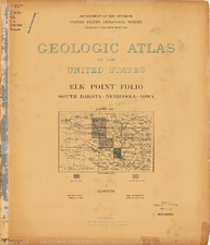
| dc.description | Elk Point folio, South Dakota-Nebraska-Iowa | en |
| dc.format.extent | 108634148 bytes | en |
| dc.format.extent | 77325934 bytes | en |
| dc.format.extent | 108211328 bytes | en |
| dc.format.extent | 108435374 bytes | en |
| dc.format.extent | 108086426 bytes | en |
| dc.format.extent | 108435374 bytes | en |
| dc.format.extent | 108911168 bytes | en |
| dc.format.extent | 107936495 bytes | en |
| dc.format.extent | 107960552 bytes | en |
| dc.format.extent | 108585791 bytes | en |
| dc.format.extent | 108260900 bytes | en |
| dc.format.extent | 108061640 bytes | en |
| dc.format.extent | 108536219 bytes | en |
| dc.format.extent | 108686150 bytes | en |
| dc.format.extent | 108886625 bytes | en |
| dc.format.extent | 108634148 bytes | en |
| dc.format.mimetype | image/tiff | |
| dc.format.mimetype | image/tiff | |
| dc.format.mimetype | image/tiff | |
| dc.format.mimetype | image/tiff | |
| dc.format.mimetype | image/tiff | |
| dc.format.mimetype | image/tiff | |
| dc.format.mimetype | image/tiff | |
| dc.format.mimetype | image/tiff | |
| dc.format.mimetype | image/tiff | |
| dc.format.mimetype | image/tiff | |
| dc.format.mimetype | application/pdf | |
| dc.format.mimetype | image/tiff | |
| dc.format.mimetype | image/tiff | |
| dc.format.mimetype | image/tiff | |
| dc.format.mimetype | image/tiff | |
| dc.format.mimetype | image/tiff | |
| dc.language.iso | en_US | |
| dc.publisher | Geological Survey (United States) | |
| dc.relation.ispartofseries | Geologic Atlas of the United States | |
| dc.relation.ispartofseries | 156 | |
| dc.rights | No copyright; for more information see: https://rightsstatements.org/page/NoC-US/1.0/ | en |
| dc.rights.uri | https://rightsstatements.org/page/NoC-US/1.0/ | |
| dc.subject | Paleogene - Arikaree formation | en |
| dc.subject | Cretaceous - Niobrara formation; Carlile shale; Greenhorn limestone; Graneros shale; Dakota sandstone | en |
| dc.subject | Neogene - Altamont terminal moraine; Arikaree formation | en |
| dc.subject.lcsh | Geology -- United States --Maps | en |
| dc.subject.lcsh | Geology -- Iowa -- Plymouth County -- Maps | en |
| dc.subject.lcsh | Geology -- South Dakota -- Clay County -- Maps | en |
| dc.subject.lcsh | Geology -- Iowa -- Sioux County -- Maps | en |
| dc.subject.lcsh | Geology -- Nebraska -- Dixon County -- Maps | en |
| dc.subject.lcsh | Geology -- Nebraska -- Dakota County -- Maps | en |
| dc.subject.lcsh | Geology -- South Dakota -- Union County -- Maps | en |
| dc.subject.lcsh | Groundwater -- Nebraska -- Dakota County -- Maps | en |
| dc.subject.lcsh | Groundwater -- Nebraska -- Dixon County -- Maps | en |
| dc.subject.lcsh | Groundwater -- Iowa -- Plymouth County -- Maps | en |
| dc.subject.lcsh | Groundwater -- Iowa -- Sioux County -- Maps | en |
| dc.subject.lcsh | Groundwater -- South Dakota -- Union County -- Maps | en |
| dc.subject.lcsh | Groundwater -- South Dakota -- Clay County -- Maps | en |
| dc.title | Elk Point folio, South Dakota-Nebraska-Iowa | en |
| dc.type | Book | en |
| dc.type | Image | en |
| dc.type | Map | en |
| dc.coverage.box | northlimit=43; westlimit=-97; southlimit=42.5; eastlimit=-96.5 | en |
| dc.coverage.point | 42:30:00N96:30:00W | en |