| dc.coverage.spatial | Oklahoma | en |
| dc.creator | Taff, Joseph A. (Joseph Alexander), b. 1862. | |
| dc.date.accessioned | 2006-05-02T16:32:08Z | |
| dc.date.accessioned | 2012-06-01T23:50:01Z | |
| dc.date.available | 2006-05-02T16:32:08Z | |
| dc.date.available | 2012-06-01T23:50:01Z | |
| dc.date.issued | 1901 | |
| dc.identifier.govdoc | I19.5/1:74 | |
| dc.identifier.uri | https://hdl.handle.net/1969.1/3396 | |
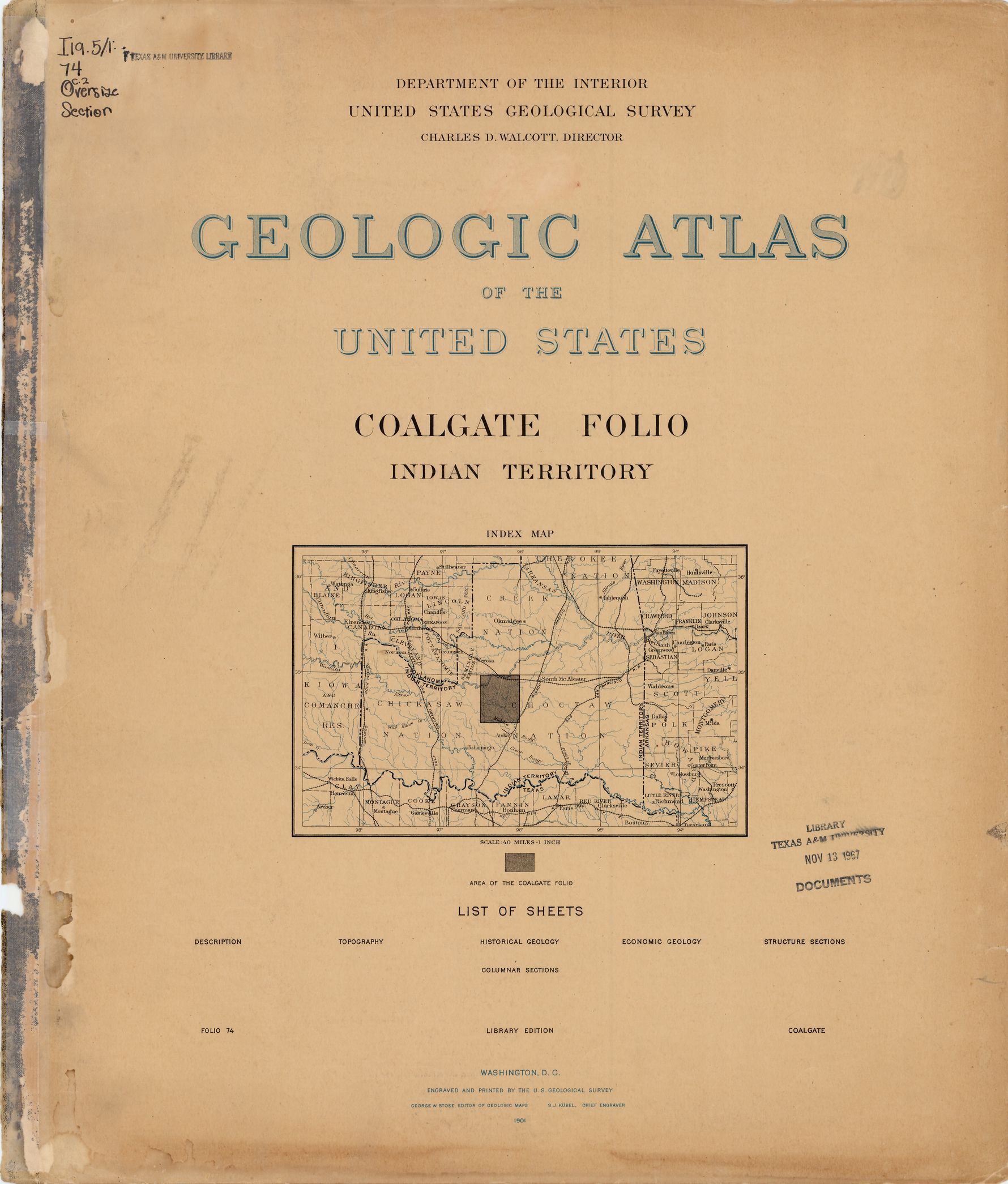
| dc.description | Coalgate folio, Indian Territory | en |
| dc.format.extent | 109285874 bytes | en |
| dc.format.extent | 109462292 bytes | en |
| dc.format.extent | 109965788 bytes | en |
| dc.format.extent | 108660392 bytes | en |
| dc.format.extent | 108536219 bytes | en |
| dc.format.extent | 108510704 bytes | en |
| dc.format.extent | 109187459 bytes | en |
| dc.format.extent | 109011770 bytes | en |
| dc.format.extent | 108810080 bytes | en |
| dc.format.extent | 108933038 bytes | en |
| dc.format.extent | 108282284 bytes | en |
| dc.format.extent | 107808920 bytes | en |
| dc.format.extent | 108756620 bytes | en |
| dc.format.extent | 109337876 bytes | en |
| dc.format.extent | 109285874 bytes | en |
| dc.format.extent | 77233944 bytes | en |
| dc.format.mimetype | image/tiff | |
| dc.format.mimetype | image/tiff | |
| dc.format.mimetype | image/tiff | |
| dc.format.mimetype | image/tiff | |
| dc.format.mimetype | image/tiff | |
| dc.format.mimetype | image/tiff | |
| dc.format.mimetype | image/tiff | |
| dc.format.mimetype | image/tiff | |
| dc.format.mimetype | image/tiff | |
| dc.format.mimetype | image/tiff | |
| dc.format.mimetype | image/tiff | |
| dc.format.mimetype | image/tiff | |
| dc.format.mimetype | image/tiff | |
| dc.format.mimetype | image/tiff | |
| dc.format.mimetype | image/tiff | |
| dc.format.mimetype | application/pdf | |
| dc.language.iso | en_US | |
| dc.publisher | Geological Survey (United States) | |
| dc.relation.ispartofseries | Geologic Atlas of the United States | |
| dc.relation.ispartofseries | 74 | |
| dc.rights | No copyright; for more information see: https://rightsstatements.org/page/NoC-US/1.0/ | en |
| dc.rights.uri | https://rightsstatements.org/page/NoC-US/1.0/ | |
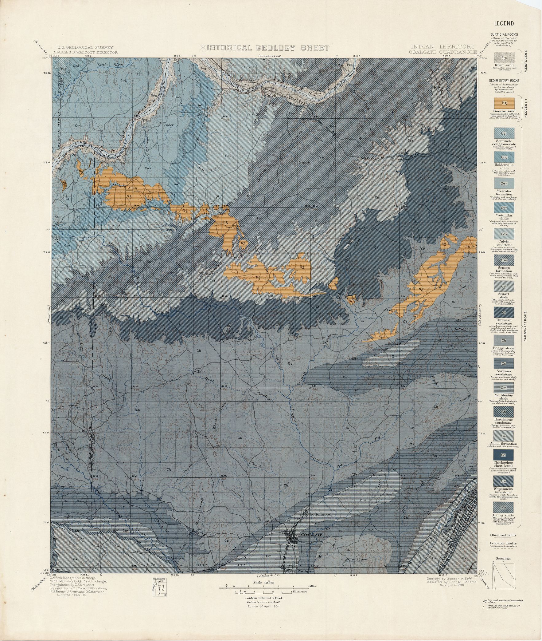
| dc.subject | Neogene - Guertie sand | en |
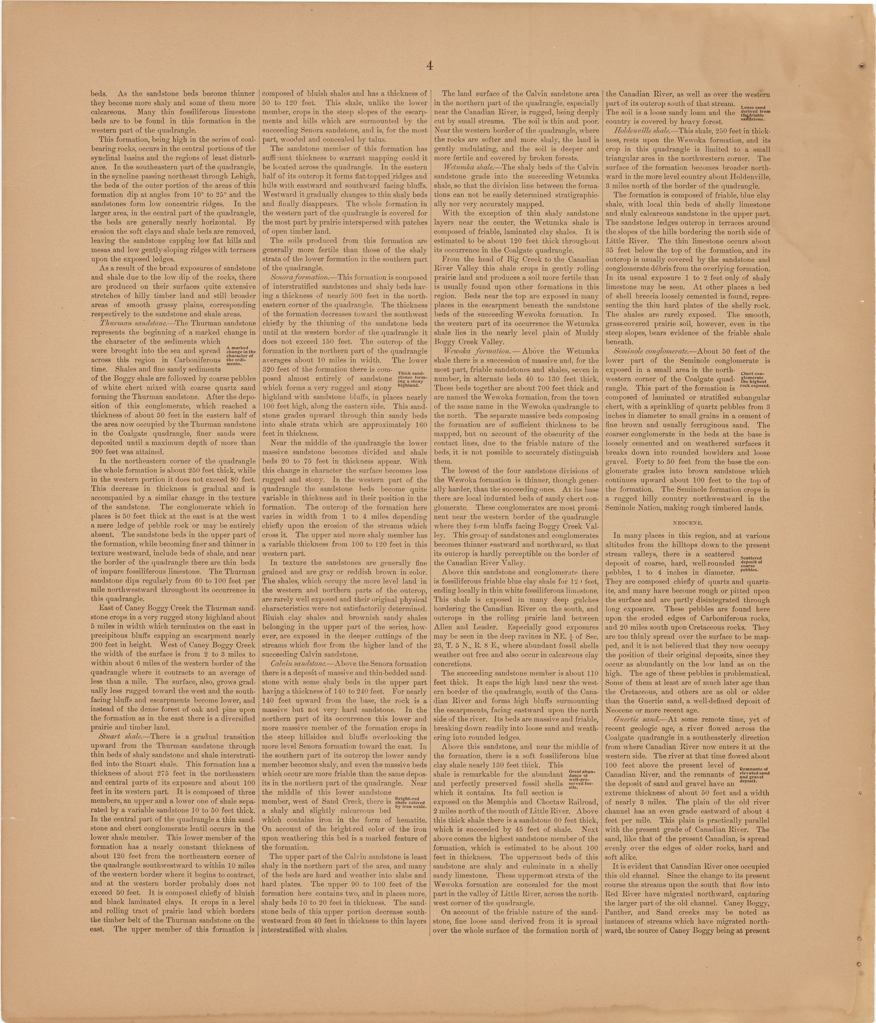
| dc.subject | Carboniferous - Seminole conglomerate; Holden shale; Wewoka formation; Wetumka shale; Calvin sandstone; Senora formation; Stuart shale; Thurman sandstone; Boggy shale; Savanna sandstone; Mc Alester shale; Hartshorne sandstone; Atoka formation; Chickachoc chert lentil; Wapanucka limestone; Caney shale | en |
| dc.subject.lcsh | Geology -- United States --Maps | en |
| dc.subject.lcsh | Geology -- Oklahoma -- Maps | en |
| dc.title | Coalgate folio, Indian Territory | en |
| dc.type | Book | en |
| dc.type | Image | en |
| dc.type | Map | en |
| dc.coverage.box | northlimit=35; westlimit=-96.5; southlimit=34.5; eastlimit=-96 | en |
| dc.coverage.point | 34:30:00N96:00:00W | en |