| dc.coverage.spatial | Tennessee | en |
| dc.creator | Campbell, Marius R. (Marius Robinson), 1858-1940. | |
| dc.date.accessioned | 2006-04-18T20:39:29Z | |
| dc.date.accessioned | 2012-06-02T06:24:46Z | |
| dc.date.available | 2006-04-18T20:39:29Z | |
| dc.date.available | 2012-06-02T06:24:46Z | |
| dc.date.issued | 1899 | |
| dc.identifier.govdoc | I19.5/1:53 | |
| dc.identifier.uri | https://hdl.handle.net/1969.1/3380 | |
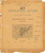
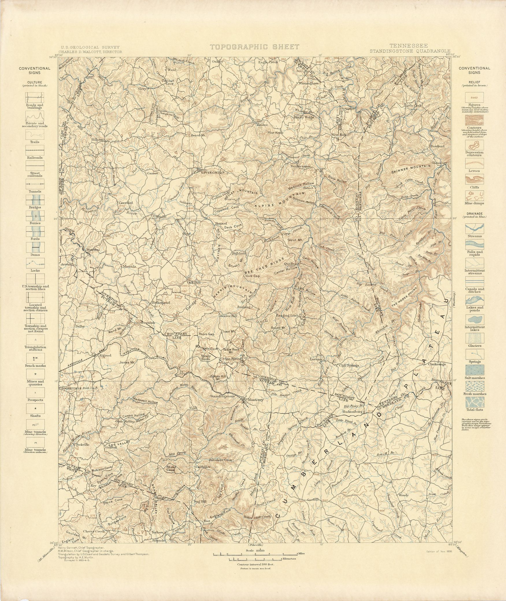
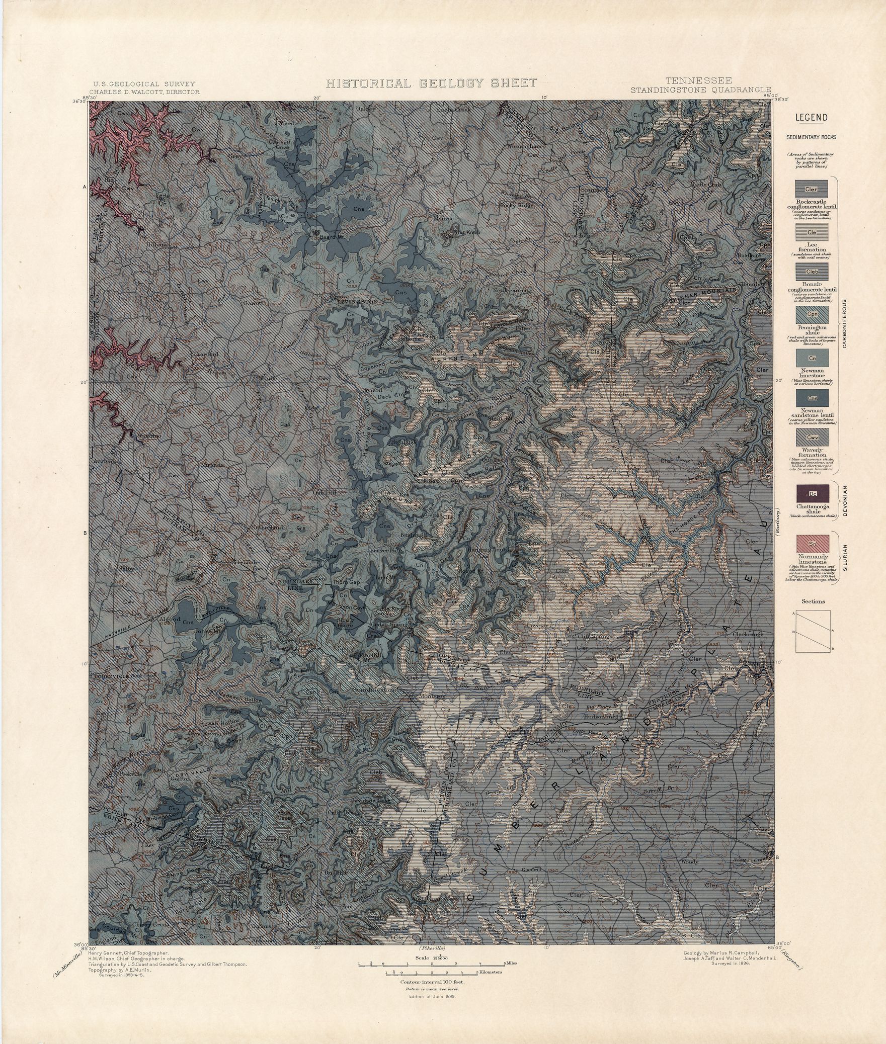
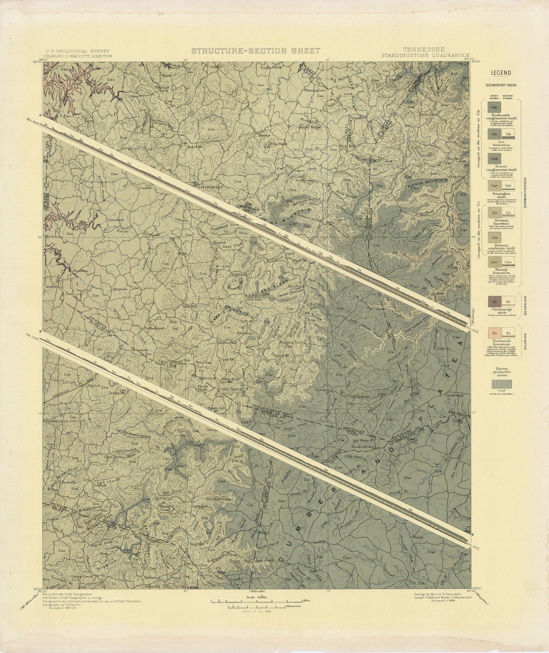
| dc.description | Standingstone folio, Tennessee | en |
| dc.format.extent | 106918400 bytes | en |
| dc.format.extent | 107098688 bytes | en |
| dc.format.extent | 107049536 bytes | en |
| dc.format.extent | 70136423 bytes | en |
| dc.format.extent | 107074304 bytes | en |
| dc.format.extent | 108142208 bytes | en |
| dc.format.extent | 107433728 bytes | en |
| dc.format.extent | 106762496 bytes | en |
| dc.format.extent | 106811648 bytes | en |
| dc.format.extent | 106942976 bytes | en |
| dc.format.extent | 107565824 bytes | en |
| dc.format.extent | 107074304 bytes | en |
| dc.format.extent | 107673920 bytes | en |
| dc.format.extent | 108298304 bytes | en |
| dc.format.mimetype | image/tiff | |
| dc.format.mimetype | image/tiff | |
| dc.format.mimetype | image/tiff | |
| dc.format.mimetype | image/tiff | |
| dc.format.mimetype | image/tiff | |
| dc.format.mimetype | image/tiff | |
| dc.format.mimetype | image/tiff | |
| dc.format.mimetype | image/tiff | |
| dc.format.mimetype | application/pdf | |
| dc.format.mimetype | image/tiff | |
| dc.format.mimetype | image/tiff | |
| dc.format.mimetype | image/tiff | |
| dc.format.mimetype | image/tiff | |
| dc.format.mimetype | image/tiff | |
| dc.language.iso | en_US | |
| dc.publisher | Geological Survey (United States) | |
| dc.relation.ispartofseries | Geologic Atlas of the United States | |
| dc.relation.ispartofseries | 53 | |
| dc.rights | No copyright; for more information see: https://rightsstatements.org/page/NoC-US/1.0/ | en |
| dc.rights.uri | https://rightsstatements.org/page/NoC-US/1.0/ | |
| dc.subject | Silurian - Normandy limestone | en |
| dc.subject | Carboniferous - Rockcastle conglomerate lentil; Lee formation; Bonair conglomerate lentil; Pennington shale; Newman limestone; Newman sandstone lentil; Waverly formation | en |
| dc.subject | Devonian - Chattanooga shale | en |
| dc.subject.lcsh | Geology -- United States --Maps | en |
| dc.subject.lcsh | Geology--Tennessee--Maps | en |
| dc.title | Standingstone folio, Tennessee | en |
| dc.type | Map | en |
| dc.type | Book | en |
| dc.type | Image | en |
| dc.coverage.box | northlimit=36.5; westlimit=-85.5; southlimit=36; eastlimit=-85 | en |
| dc.coverage.point | 36:00:00N85:00:00W | en |