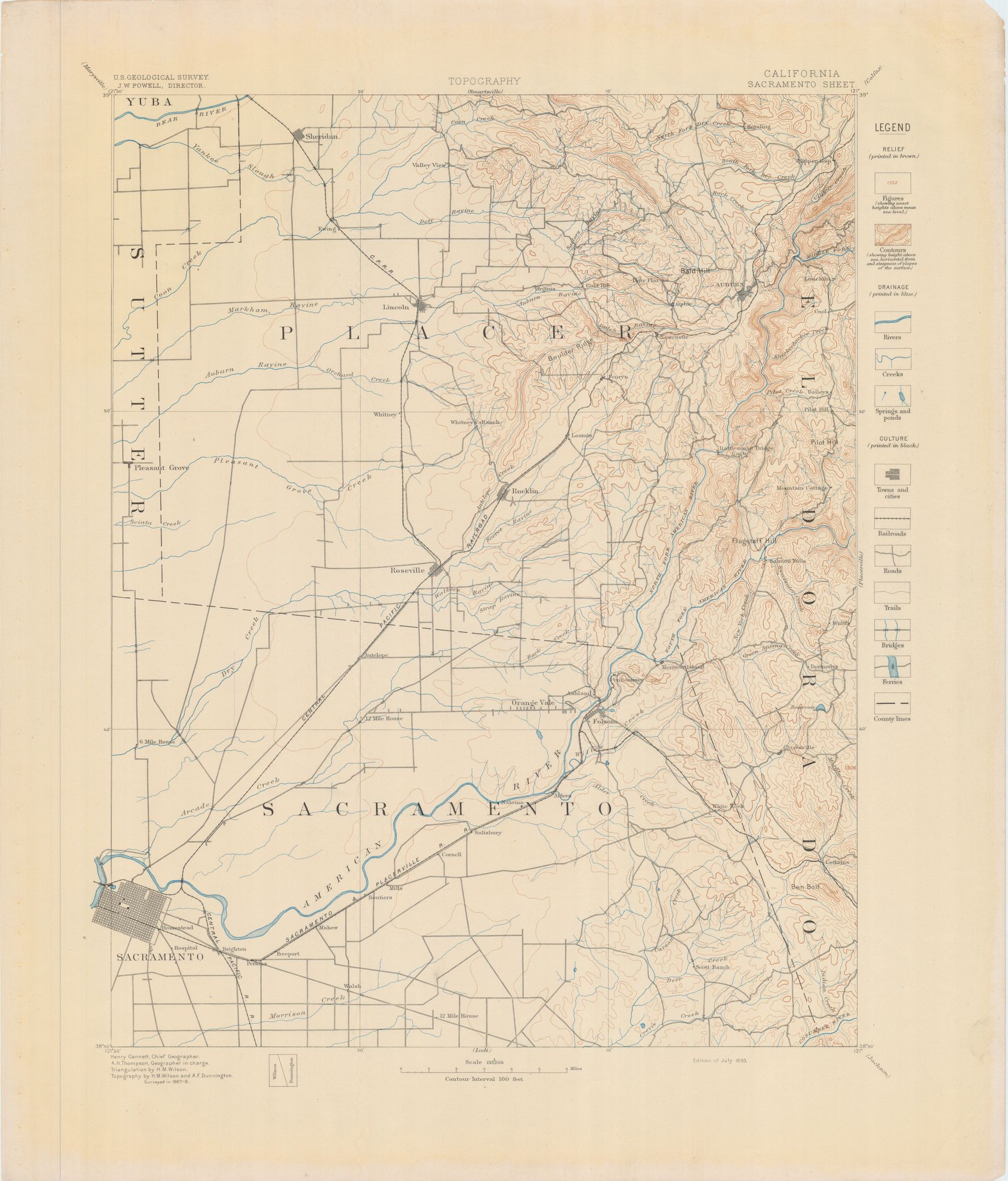
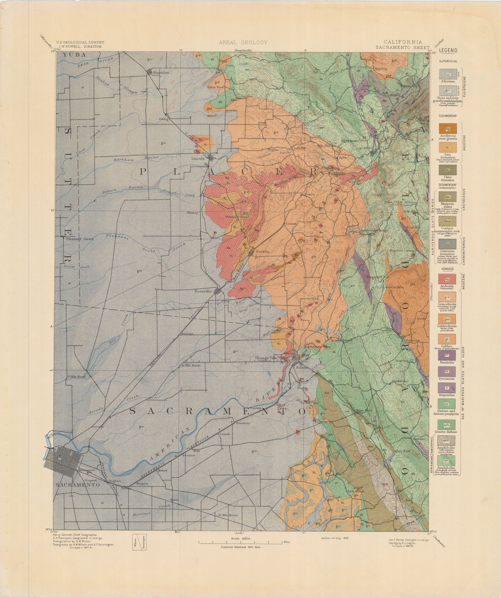
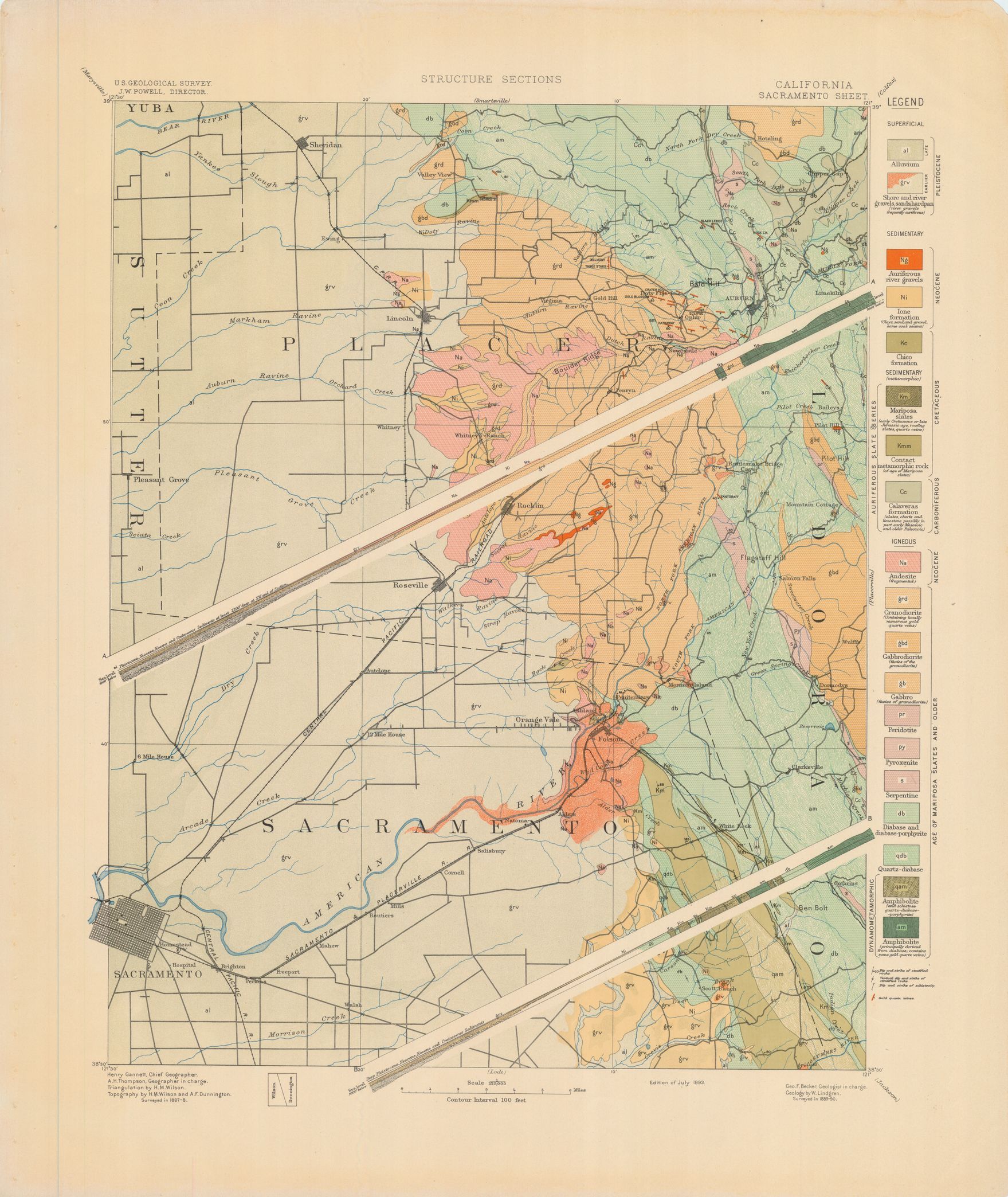
| dc.coverage.spatial | California | en |
| dc.creator | Lindgren, Waldemar, 1860-1939. | |
| dc.date.accessioned | 2006-03-31T15:40:46Z | |
| dc.date.accessioned | 2012-06-02T04:21:45Z | |
| dc.date.available | 2006-03-31T15:40:46Z | |
| dc.date.available | 2012-06-02T04:21:45Z | |
| dc.date.issued | 1894 | |
| dc.identifier.govdoc | I19.5/1:5 | |
| dc.identifier.uri | https://hdl.handle.net/1969.1/3006 | |
| dc.description | Sacramento folio, California | en |
| dc.format.extent | 107099236 bytes | en |
| dc.format.extent | 107495028 bytes | en |
| dc.format.extent | 108998712 bytes | en |
| dc.format.extent | 106751188 bytes | en |
| dc.format.extent | 108075548 bytes | en |
| dc.format.extent | 58658152 bytes | en |
| dc.format.extent | 107630140 bytes | en |
| dc.format.extent | 107731212 bytes | en |
| dc.format.extent | 108088968 bytes | en |
| dc.format.extent | 107976584 bytes | en |
| dc.format.extent | 107691220 bytes | en |
| dc.format.extent | 103756252 bytes | en |
| dc.format.mimetype | image/tiff | |
| dc.format.mimetype | image/tiff | |
| dc.format.mimetype | image/tiff | |
| dc.format.mimetype | image/tiff | |
| dc.format.mimetype | image/tiff | |
| dc.format.mimetype | image/tiff | |
| dc.format.mimetype | image/tiff | |
| dc.format.mimetype | image/tiff | |
| dc.format.mimetype | image/tiff | |
| dc.format.mimetype | image/tiff | |
| dc.format.mimetype | image/tiff | |
| dc.format.mimetype | application/pdf | |
| dc.language.iso | en_US | |
| dc.publisher | Geological Survey (United States) | |
| dc.relation.ispartofseries | 5 | |
| dc.relation.ispartofseries | Geologic Atlas of the United States | |
| dc.rights | No copyright; for more information see: https://rightsstatements.org/page/NoC-US/1.0/ | en |
| dc.rights.uri | https://rightsstatements.org/page/NoC-US/1.0/ | |
| dc.subject | Neogene - Ione formation; Chico formation | en |
| dc.subject | Carboniferous - Calaveras formation | en |
| dc.subject | Cretaceous - Mariposa slates | en |
| dc.subject.lcsh | Geology -- United States --Maps | en |
| dc.subject.lcsh | Geology--California--Maps | en |
| dc.title | Sacramento folio, California | en |
| dc.type | Map | en |
| dc.type | Book | en |
| dc.type | Image | en |
| dc.coverage.box | northlimit=39; westlimit=-121.5; southlimit=38.5; eastlimit=-121 | en |
| dc.coverage.point | 38:30:00N121:00:00W | en |