| dc.coverage.spatial | North Carolina | en |
| dc.coverage.spatial | Tennessee | en |
| dc.creator | Keith, Arthur. | |
| dc.date.accessioned | 2006-03-07T17:06:59Z | |
| dc.date.accessioned | 2012-06-01T19:56:35Z | |
| dc.date.available | 2006-03-07T17:06:59Z | |
| dc.date.available | 2012-06-01T19:56:35Z | |
| dc.date.issued | 1905 | |
| dc.identifier.govdoc | I19.5/1:124 | |
| dc.identifier.uri | https://hdl.handle.net/1969.1/2955 | |
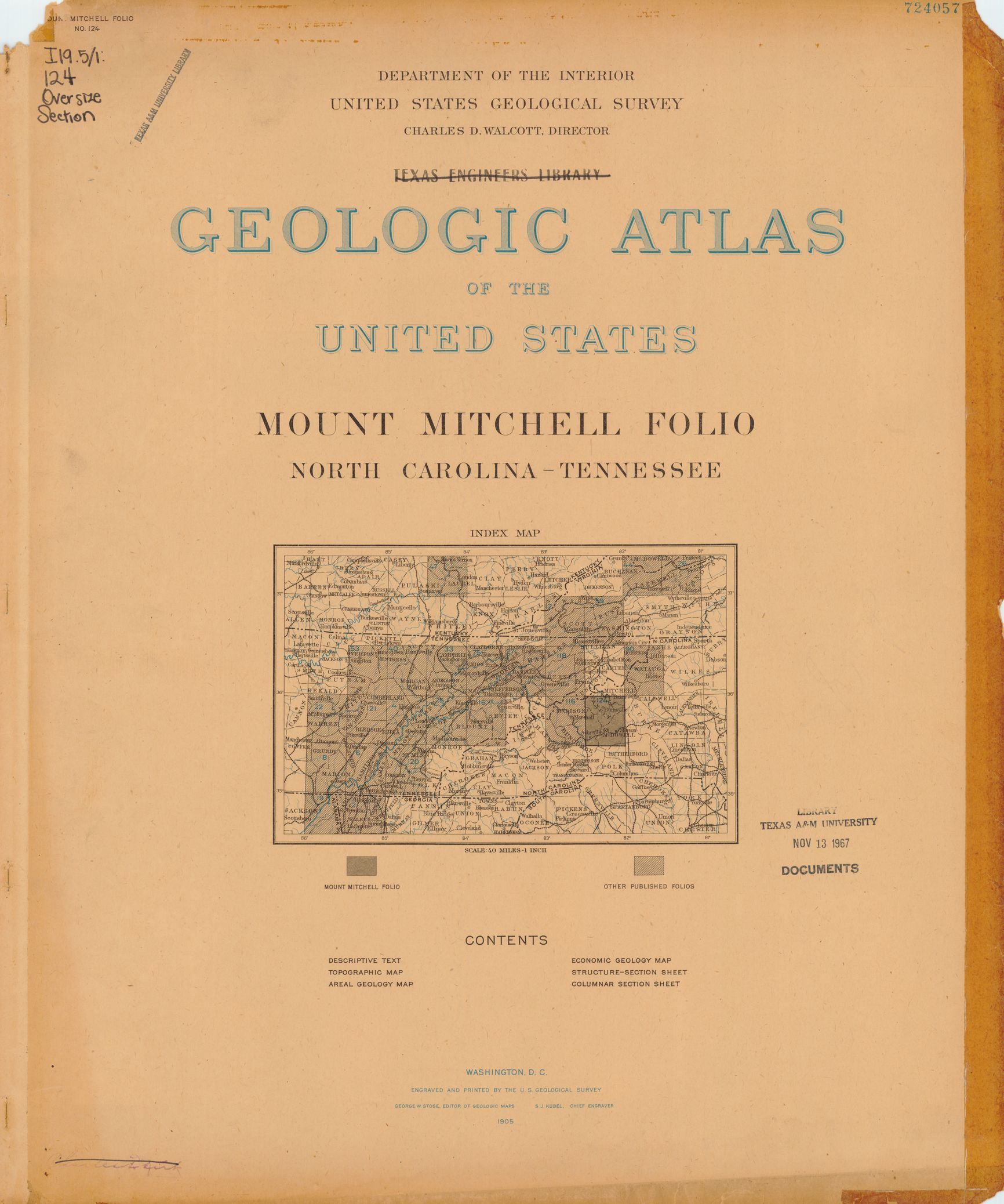
| dc.description | Mount Mitchell folio, North Carolina-Tennessee | en |
| dc.format.extent | 106679372 bytes | en |
| dc.format.extent | 105189236 bytes | en |
| dc.format.extent | 104994376 bytes | en |
| dc.format.extent | 105169508 bytes | en |
| dc.format.extent | 106238608 bytes | en |
| dc.format.extent | 105412484 bytes | en |
| dc.format.extent | 105299788 bytes | en |
| dc.format.extent | 105415972 bytes | en |
| dc.format.extent | 104820524 bytes | en |
| dc.format.extent | 107157064 bytes | en |
| dc.format.extent | 106414088 bytes | en |
| dc.format.extent | 106841272 bytes | en |
| dc.format.extent | 107521216 bytes | en |
| dc.format.extent | 105178884 bytes | en |
| dc.format.extent | 105746532 bytes | en |
| dc.format.extent | 107568972 bytes | en |
| dc.format.extent | 95281195 bytes | en |
| dc.format.extent | 107274864 bytes | en |
| dc.format.extent | 107719300 bytes | en |
| dc.format.mimetype | image/tiff | |
| dc.format.mimetype | image/tiff | |
| dc.format.mimetype | image/tiff | |
| dc.format.mimetype | image/tiff | |
| dc.format.mimetype | image/tiff | |
| dc.format.mimetype | image/tiff | |
| dc.format.mimetype | image/tiff | |
| dc.format.mimetype | image/tiff | |
| dc.format.mimetype | application/pdf | |
| dc.format.mimetype | image/tiff | |
| dc.format.mimetype | image/tiff | |
| dc.format.mimetype | image/tiff | |
| dc.format.mimetype | image/tiff | |
| dc.format.mimetype | image/tiff | |
| dc.format.mimetype | image/tiff | |
| dc.format.mimetype | image/tiff | |
| dc.format.mimetype | image/tiff | |
| dc.format.mimetype | image/tiff | |
| dc.format.mimetype | image/tiff | |
| dc.language.iso | en_US | |
| dc.publisher | Geological Survey (United States) | |
| dc.relation.ispartofseries | Geologic Atlas of the United States | |
| dc.relation.ispartofseries | 124 | |
| dc.rights | No copyright; for more information see: https://rightsstatements.org/page/NoC-US/1.0/ | en |
| dc.rights.uri | https://rightsstatements.org/page/NoC-US/1.0/ | |
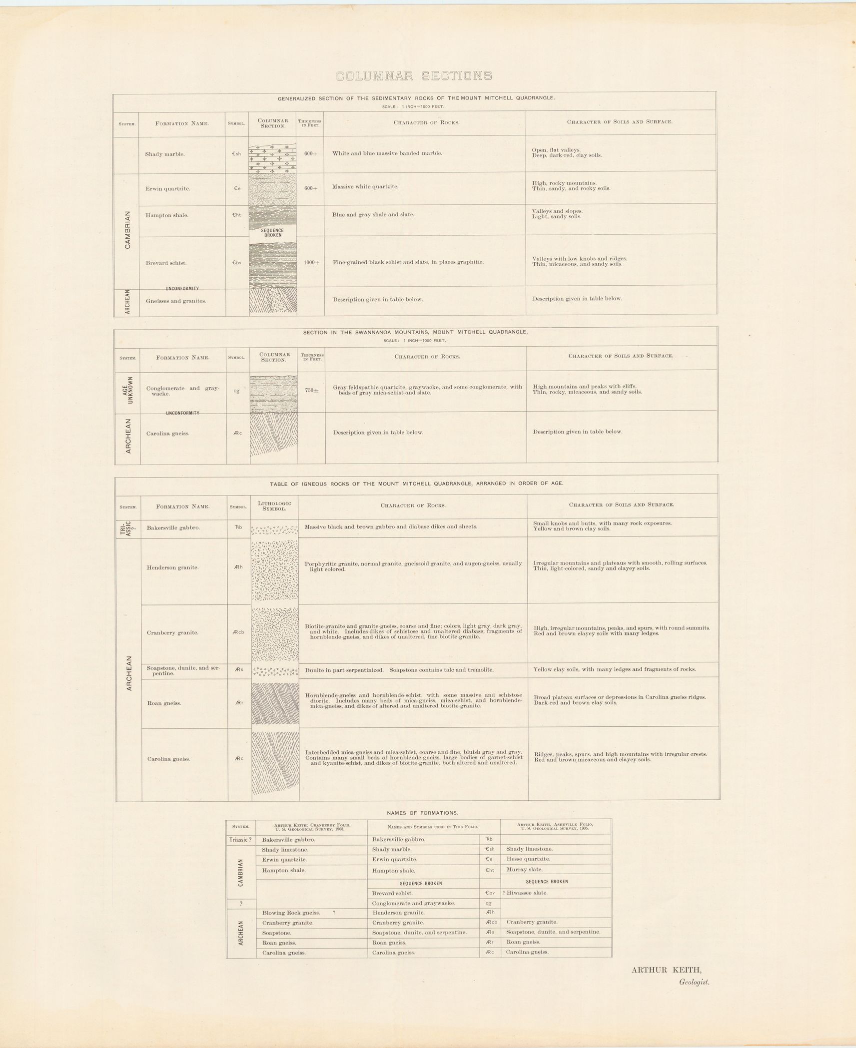
| dc.subject | Archean - Henderson granite; Cranberry granite; Roan gneiss; Carolina gneiss | en |
| dc.subject | Triassic - Bakersville gabbro | en |
| dc.subject | Cambrian - Shady marble; Erwin quartzite; Hampton shale; Brevard schist | en |
| dc.subject.lcsh | Geology -- North Carolina -- Madison County -- Maps | en |
| dc.subject.lcsh | Geology -- North Carolina -- Mitchell County -- Maps | en |
| dc.subject.lcsh | Geology -- United States --Maps | en |
| dc.subject.lcsh | Geology -- Tennessee -- Unicoi County -- Maps | en |
| dc.subject.lcsh | Geology -- North Carolina -- Yancey County -- Maps | en |
| dc.subject.lcsh | Geology -- North Carolina -- Rutherford County -- Maps | en |
| dc.subject.lcsh | Geology -- North Carolina -- Buncombe County -- Maps | en |
| dc.subject.lcsh | Geology -- North Carolina -- McDowell County -- Maps | en |
| dc.title | Mount Mitchell folio, North Carolina-Tennessee | en |
| dc.type | Image | en |
| dc.type | Map | en |
| dc.type | Book | en |
| dc.coverage.box | northlimit=36; westlimit=-82.5; southlimit=35.5; eastlimit=-82 | en |
| dc.coverage.point | 35:30:00N82:00:00W | en |