| dc.coverage.spatial | Washington (D.C.) | en |
| dc.coverage.spatial | Maryland | en |
| dc.coverage.spatial | Virginia | en |
| dc.creator | Darton, Nelson Horatio, 1865-1948. | |
| dc.date.accessioned | 2006-02-14T16:04:14Z | |
| dc.date.accessioned | 2012-06-01T19:38:29Z | |
| dc.date.available | 2006-02-14T16:04:14Z | |
| dc.date.available | 2012-06-01T19:38:29Z | |
| dc.date.issued | 1901 | |
| dc.identifier.govdoc | I19.5/1:70 | |
| dc.identifier.uri | https://hdl.handle.net/1969.1/2923 | |
| dc.description | Washington folio, District of Columbia-Maryland-Virginia | en |
| dc.format.extent | 105455440 bytes | en |
| dc.format.extent | 105379872 bytes | en |
| dc.format.extent | 104773272 bytes | en |
| dc.format.extent | 104610212 bytes | en |
| dc.format.extent | 103903508 bytes | en |
| dc.format.extent | 105601936 bytes | en |
| dc.format.extent | 106025408 bytes | en |
| dc.format.extent | 103755184 bytes | en |
| dc.format.extent | 105321320 bytes | en |
| dc.format.extent | 203349800 bytes | en |
| dc.format.extent | 201258176 bytes | en |
| dc.format.extent | 200187624 bytes | en |
| dc.format.extent | 106798212 bytes | en |
| dc.format.extent | 106522688 bytes | en |
| dc.format.extent | 107624644 bytes | en |
| dc.format.extent | 31841918 bytes | en |
| dc.format.mimetype | image/tiff | |
| dc.format.mimetype | image/tiff | |
| dc.format.mimetype | image/tiff | |
| dc.format.mimetype | image/tiff | |
| dc.format.mimetype | image/tiff | |
| dc.format.mimetype | image/tiff | |
| dc.format.mimetype | image/tiff | |
| dc.format.mimetype | image/tiff | |
| dc.format.mimetype | image/tiff | |
| dc.format.mimetype | image/tiff | |
| dc.format.mimetype | image/tiff | |
| dc.format.mimetype | image/tiff | |
| dc.format.mimetype | image/tiff | |
| dc.format.mimetype | image/tiff | |
| dc.format.mimetype | image/tiff | |
| dc.format.mimetype | application/pdf | |
| dc.language.iso | en_US | |
| dc.publisher | Geological Survey (United States) | |
| dc.relation.ispartofseries | Geologic Atlas of the United States | |
| dc.relation.ispartofseries | 70 | |
| dc.rights | No copyright; for more information see: https://rightsstatements.org/page/NoC-US/1.0/ | en |
| dc.rights.uri | https://rightsstatements.org/page/NoC-US/1.0/ | |
| dc.subject | Neogene - Lafayette formation; Chesapeake formation | en |
| dc.subject | Paleogene - Pamunkey formation | en |
| dc.subject | Cretaceous - Monmouth formation; Matawan formation; Potomac formation | en |
| dc.subject | Archean - Carolina gneiss | en |
| dc.subject.lcsh | Geology -- United States --Maps | en |
| dc.subject.lcsh | Geology--Washington (D.C.)--Maps | en |
| dc.subject.lcsh | Geology--Maryland--Maps | en |
| dc.subject.lcsh | Geology--Virginia--Maps | en |
| dc.title | Washington folio, District of Columbia-Maryland-Virginia | en |
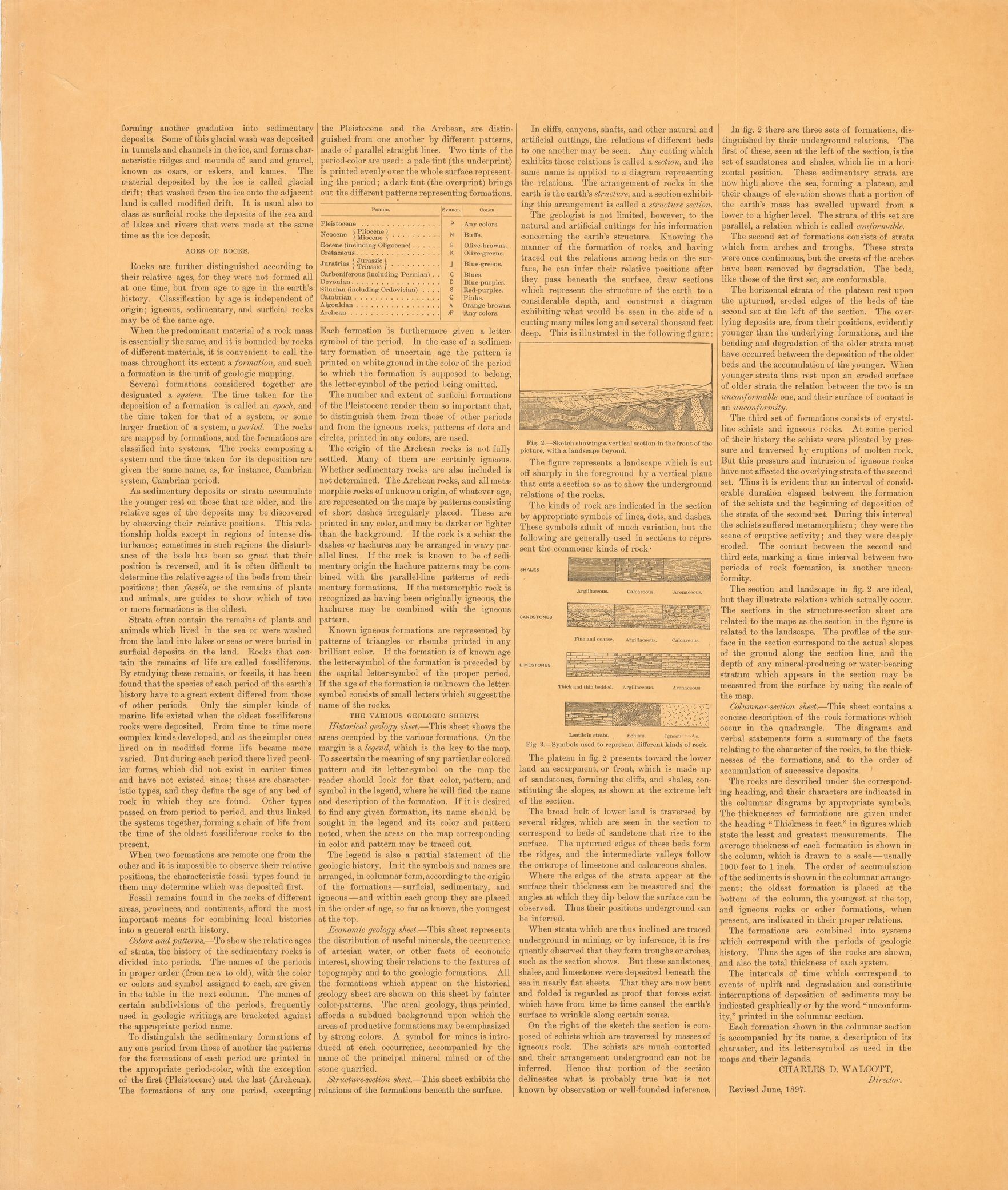
| dc.type | Book | en |
| dc.type | Image | en |
| dc.type | Map | en |
| dc.coverage.box | northlimit=39; westlimit=-77.25; southlimit=38.75; eastlimit=-76.75 | en |
| dc.coverage.point | 38:45:00N76:45:00W | en |