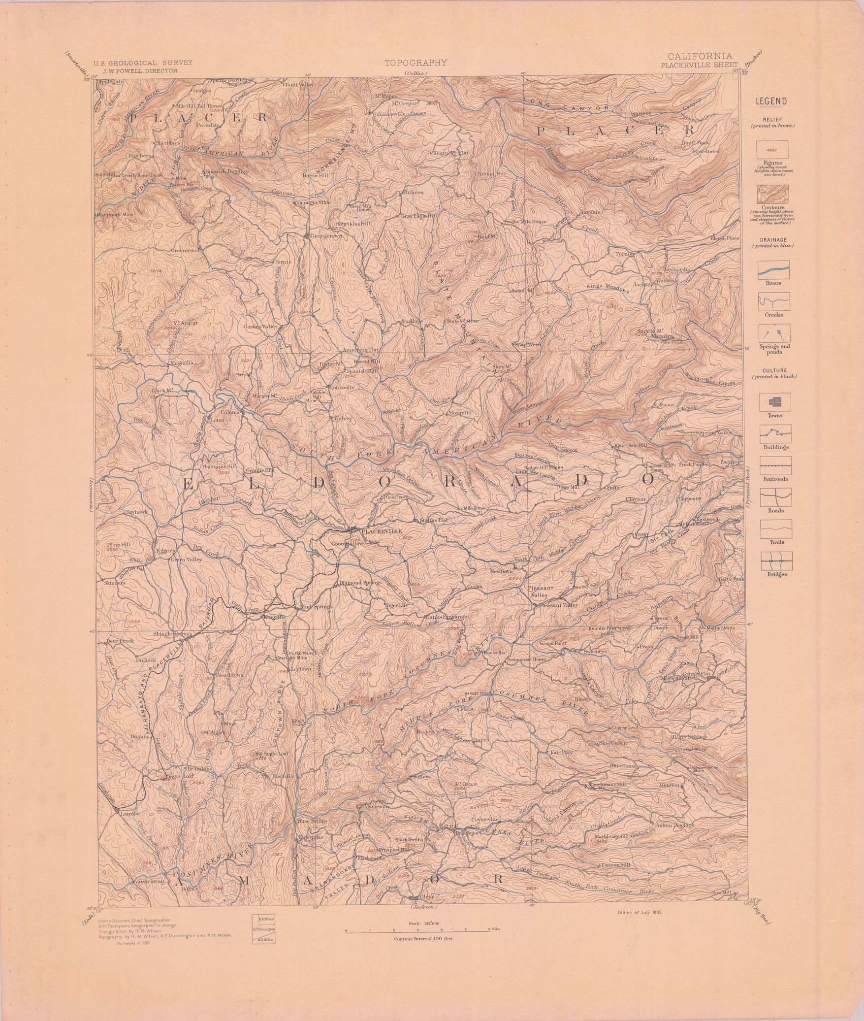
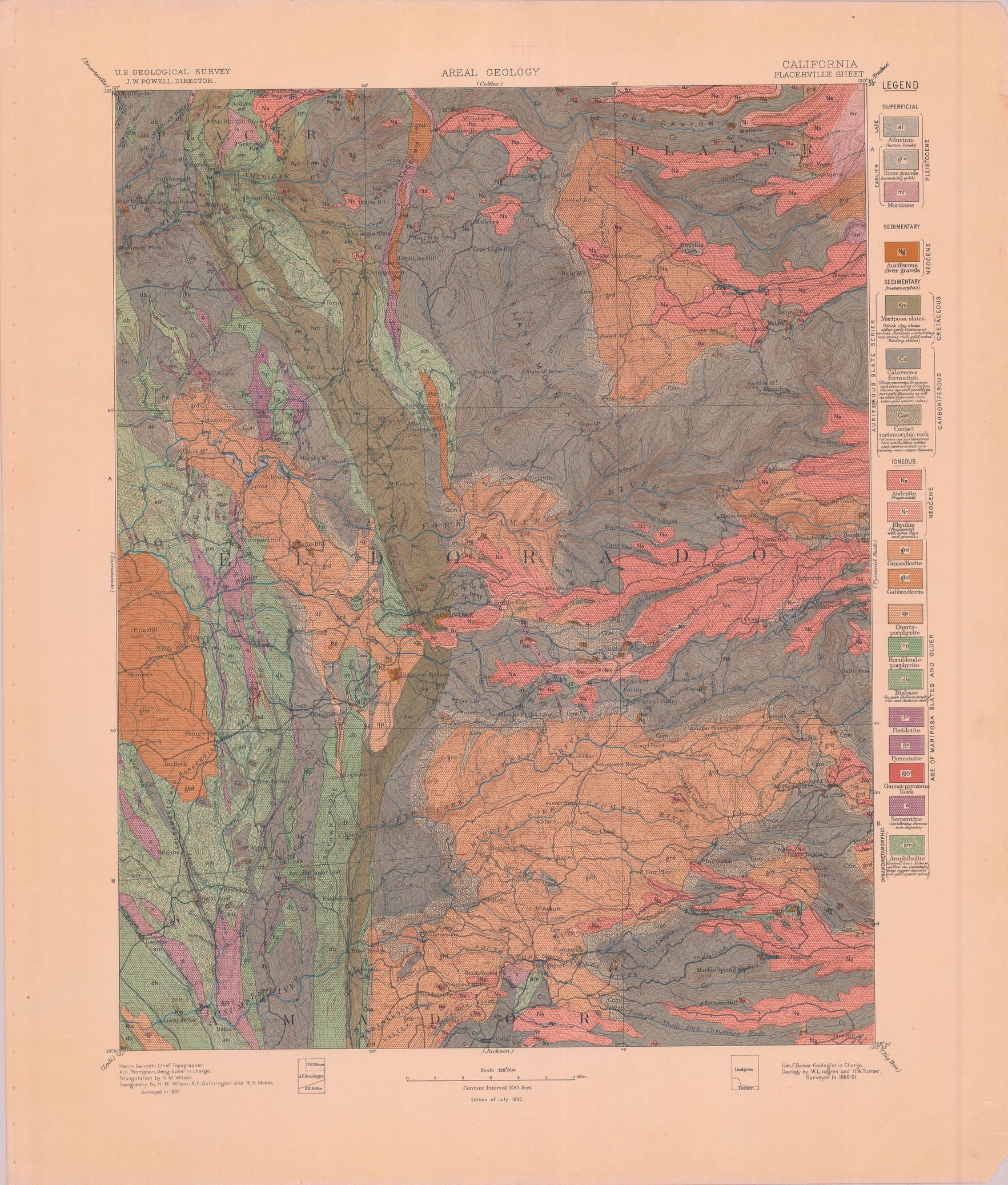
| dc.coverage.spatial | California--El Dorado County | en |
| dc.coverage.spatial | California--Amador County | en |
| dc.creator | Turner, Henry Ward, b. 1857. | |
| dc.date.accessioned | 2005-12-02T20:45:44Z | |
| dc.date.accessioned | 2012-06-01T22:21:47Z | |
| dc.date.available | 2005-12-02T20:45:44Z | |
| dc.date.available | 2012-06-01T22:21:47Z | |
| dc.date.issued | 1894 | |
| dc.identifier.govdoc | I19.5/1:3 | |
| dc.identifier.uri | https://hdl.handle.net/1969.1/2810 | |
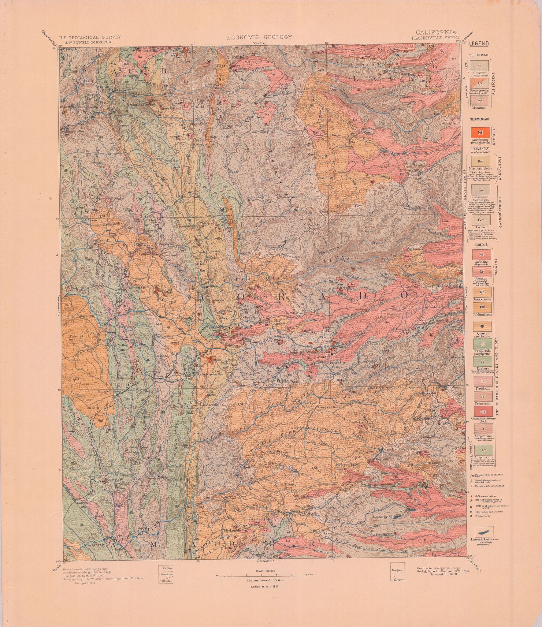
| dc.description | Placerville folio, California | en |
| dc.format.extent | 106726392 bytes | en |
| dc.format.extent | 106017228 bytes | en |
| dc.format.extent | 107573272 bytes | en |
| dc.format.extent | 107230780 bytes | en |
| dc.format.extent | 106610972 bytes | en |
| dc.format.extent | 16311649 bytes | en |
| dc.format.extent | 106363808 bytes | en |
| dc.format.extent | 106882140 bytes | en |
| dc.format.extent | 107422452 bytes | en |
| dc.format.extent | 107440804 bytes | en |
| dc.format.extent | 107473048 bytes | en |
| dc.format.mimetype | image/tiff | |
| dc.format.mimetype | image/tiff | |
| dc.format.mimetype | image/tiff | |
| dc.format.mimetype | image/tiff | |
| dc.format.mimetype | image/tiff | |
| dc.format.mimetype | image/tiff | |
| dc.format.mimetype | application/pdf | |
| dc.format.mimetype | image/tiff | |
| dc.format.mimetype | image/tiff | |
| dc.format.mimetype | image/tiff | |
| dc.format.mimetype | image/tiff | |
| dc.language.iso | en_US | |
| dc.publisher | Geological Survey (United States) | |
| dc.relation.ispartofseries | 3 | |
| dc.relation.ispartofseries | Geologic Atlas of the United States | |
| dc.rights | No copyright; for more information see: https://rightsstatements.org/page/NoC-US/1.0/ | en |
| dc.rights.uri | https://rightsstatements.org/page/NoC-US/1.0/ | |
| dc.subject | Neogene - unnamed strata | en |
| dc.subject | Cretaceous - Mariposa slates | en |
| dc.subject | Carboniferous - Calaveras formation | en |
| dc.subject.lcsh | Geology--California--El Dorado County--Maps | en |
| dc.subject.lcsh | Geology -- United States --Maps | en |
| dc.subject.lcsh | Geology--California--Amador County--Maps | en |
| dc.title | Placerville folio, California | en |
| dc.type | Map | en |
| dc.type | Book | en |
| dc.type | Image | en |
| dc.coverage.box | northlimit=39; westlimit=-121; southlimit=38.5; eastlimit=-120.5 | en |
| dc.coverage.point | 38:30:00N120:30:00W | en |