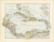
Westindien und Zentralamerika
Date
1903Metadata
Show full item recordDescription
13 x 10 inch map taken from:Süd- und Mittelamerika (Book) xii, 665 p., [39] leaves of plates illus., (some col.) ports., maps (some fold.) 26 cm.Subject
West Indies -- MapsCollections
Citation
(1903). Westindien und Zentralamerika. Leipzig und Wien, Bibliographisches institut. Available electronically from https : / /hdl .handle .net /1969 .1 /147611.