| dc.coverage.spatial | Colorado | en |
| dc.creator | Fisher, Cassius Asa, 1872-1930. | |
| dc.date.accessioned | 2006-05-31T21:41:26Z | |
| dc.date.accessioned | 2012-06-02T03:07:26Z | |
| dc.date.available | 2006-05-31T21:41:26Z | |
| dc.date.available | 2012-06-02T03:07:26Z | |
| dc.date.issued | 1906 | |
| dc.identifier.govdoc | I19.5/1:135 | |
| dc.identifier.uri | https://hdl.handle.net/1969.1/3517 | |
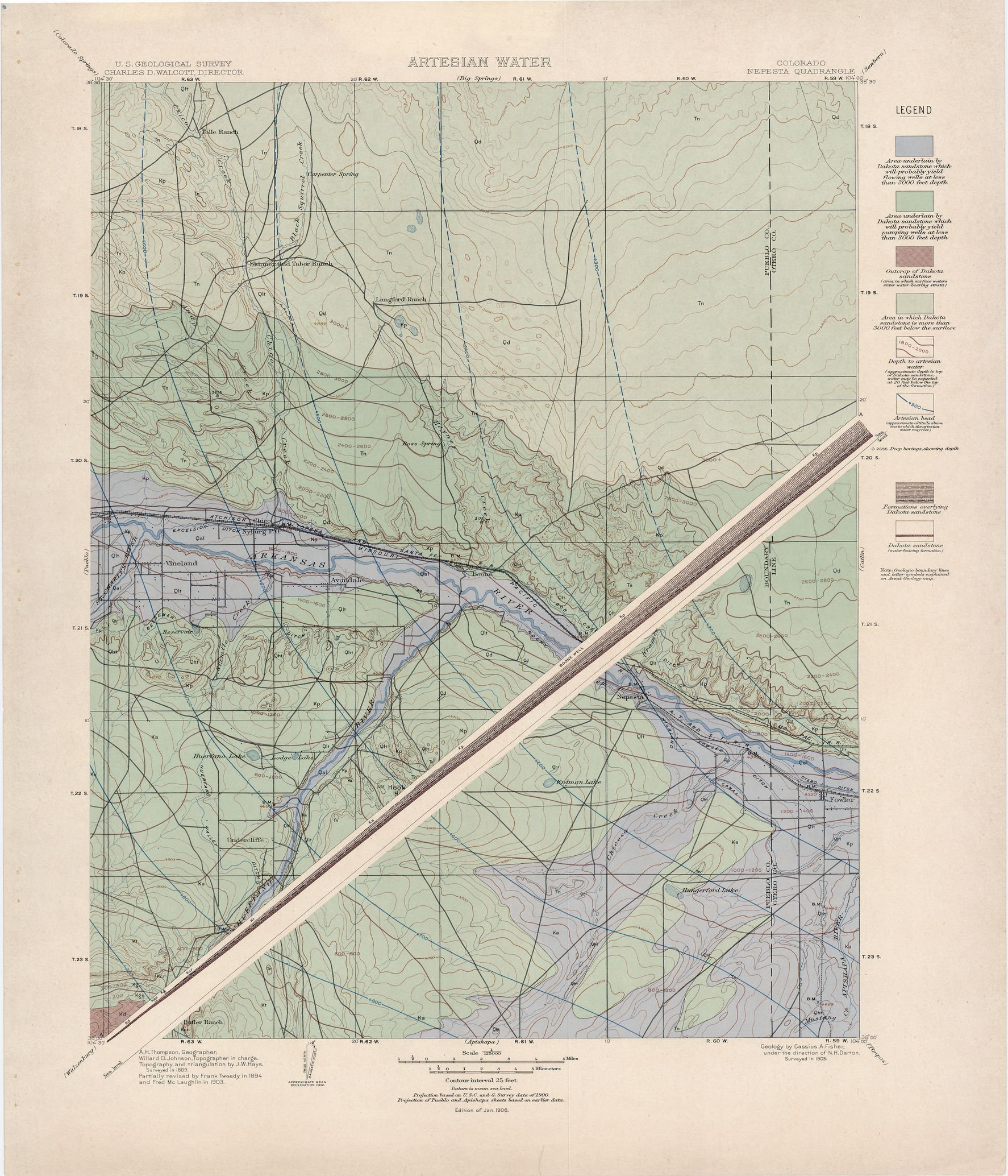
| dc.description | Nepesta folio, Colorado | en |
| dc.format.extent | 107886923 bytes | en |
| dc.format.extent | 107886923 bytes | en |
| dc.format.extent | 107563004 bytes | en |
| dc.format.extent | 107660204 bytes | en |
| dc.format.extent | 107537489 bytes | en |
| dc.format.extent | 107911952 bytes | en |
| dc.format.extent | 107686448 bytes | en |
| dc.format.extent | 65962006 bytes | en |
| dc.format.extent | 108335258 bytes | en |
| dc.format.extent | 108607418 bytes | en |
| dc.format.extent | 108510704 bytes | en |
| dc.format.extent | 108185813 bytes | en |
| dc.format.extent | 107537489 bytes | en |
| dc.format.extent | 107686448 bytes | en |
| dc.format.mimetype | image/tiff | |
| dc.format.mimetype | image/tiff | |
| dc.format.mimetype | image/tiff | |
| dc.format.mimetype | image/tiff | |
| dc.format.mimetype | image/tiff | |
| dc.format.mimetype | image/tiff | |
| dc.format.mimetype | image/tiff | |
| dc.format.mimetype | image/tiff | |
| dc.format.mimetype | image/tiff | |
| dc.format.mimetype | image/tiff | |
| dc.format.mimetype | image/tiff | |
| dc.format.mimetype | image/tiff | |
| dc.format.mimetype | application/pdf | |
| dc.format.mimetype | image/tiff | |
| dc.language.iso | en_US | |
| dc.publisher | Geological Survey (United States) | |
| dc.relation.ispartofseries | 135 | |
| dc.relation.ispartofseries | Geologic Atlas of the United States | |
| dc.rights | No copyright; for more information see: https://rightsstatements.org/page/NoC-US/1.0/ | en |
| dc.rights.uri | https://rightsstatements.org/page/NoC-US/1.0/ | |
| dc.subject | Paleogene - Nussbaum formation | en |
| dc.subject | Cretaceous - Pierre shale; Apishapa formation; Timpas formation; Carlile shale; Greenhorn limestone; Graneros shale; Dakota sandstone | en |
| dc.subject | Neogene - Nussbaum formation | en |
| dc.subject.lcsh | Groundwater -- Colorado -- Otero County -- Maps | en |
| dc.subject.lcsh | Groundwater -- Colorado -- Pueblo County -- Maps | en |
| dc.subject.lcsh | Geology -- Colorado -- Otero County -- Maps | en |
| dc.subject.lcsh | Geology -- Colorado -- Pueblo County -- Maps | en |
| dc.subject.lcsh | Geology -- United States --Maps | en |
| dc.title | Nepesta folio, Colorado | en |
| dc.type | Book | en |
| dc.type | Image | en |
| dc.type | Map | en |
| dc.coverage.box | northlimit=38.5; westlimit=-104.5; southlimit=38; eastlimit=-104 | en |
| dc.coverage.point | 38:00:00N104:00:00W | en |