| dc.coverage.spatial | Texas | en |
| dc.creator | Hill, Robert Thomas, 1858-1941. | |
| dc.date.accessioned | 2006-04-11T19:41:02Z | |
| dc.date.accessioned | 2012-06-02T01:27:33Z | |
| dc.date.available | 2006-04-11T19:41:02Z | |
| dc.date.available | 2012-06-02T01:27:33Z | |
| dc.date.issued | 1897 | |
| dc.identifier.govdoc | I19.5/1:42 | |
| dc.identifier.uri | https://hdl.handle.net/1969.1/3040 | |
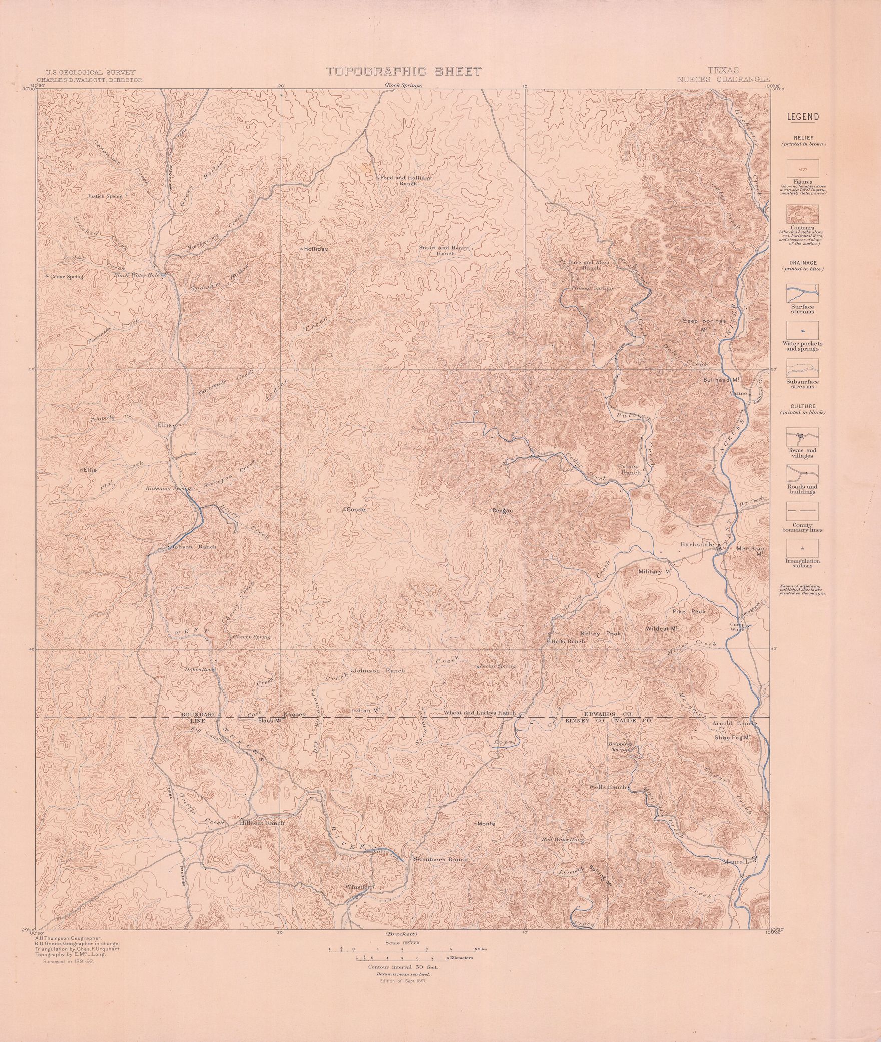
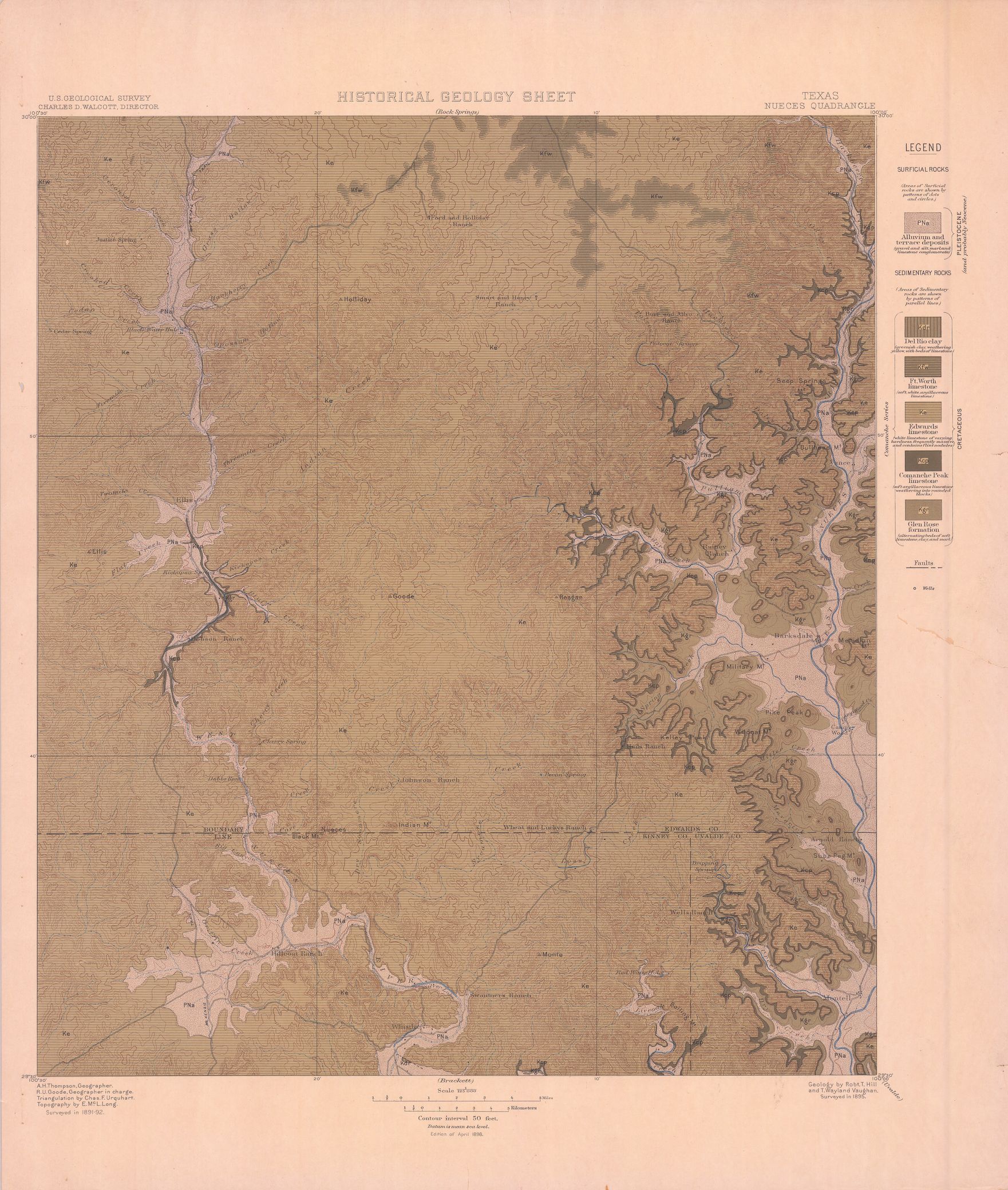
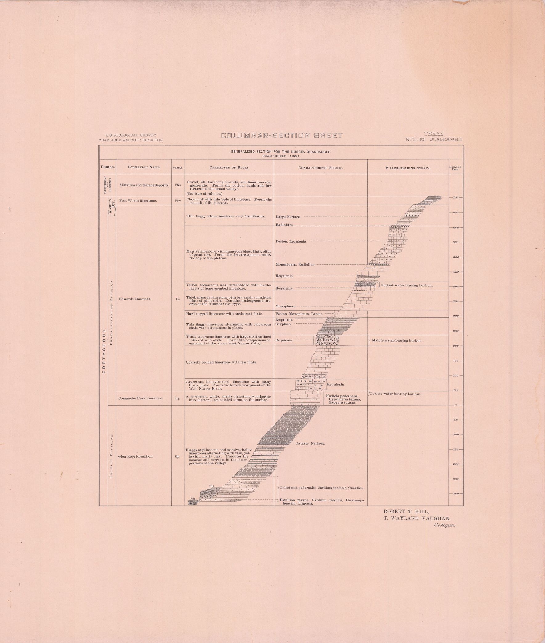
| dc.description | Nueces folio, Texas | en |
| dc.format.extent | 101062956 bytes | en |
| dc.format.extent | 100584524 bytes | en |
| dc.format.extent | 106849300 bytes | en |
| dc.format.extent | 107280180 bytes | en |
| dc.format.extent | 107902508 bytes | en |
| dc.format.extent | 107221468 bytes | en |
| dc.format.extent | 107325192 bytes | en |
| dc.format.extent | 96087472 bytes | en |
| dc.format.extent | 96620740 bytes | en |
| dc.format.extent | 15251708 bytes | en |
| dc.format.extent | 108378252 bytes | en |
| dc.format.extent | 108205876 bytes | en |
| dc.format.extent | 108090780 bytes | en |
| dc.format.mimetype | image/tiff | |
| dc.format.mimetype | image/tiff | |
| dc.format.mimetype | image/tiff | |
| dc.format.mimetype | image/tiff | |
| dc.format.mimetype | image/tiff | |
| dc.format.mimetype | image/tiff | |
| dc.format.mimetype | image/tiff | |
| dc.format.mimetype | image/tiff | |
| dc.format.mimetype | image/tiff | |
| dc.format.mimetype | image/tiff | |
| dc.format.mimetype | image/tiff | |
| dc.format.mimetype | image/tiff | |
| dc.format.mimetype | application/pdf | |
| dc.language.iso | en_US | |
| dc.publisher | Geological Survey (United States) | |
| dc.relation.ispartofseries | Geologic Atlas of the United States | |
| dc.relation.ispartofseries | 42 | |
| dc.rights | No copyright; for more information see: https://rightsstatements.org/page/NoC-US/1.0/ | en |
| dc.rights.uri | https://rightsstatements.org/page/NoC-US/1.0/ | |
| dc.subject | Cretaceous - Del Rio clay; Ft. Worth limestone; Edwards limestone; Comanche Peak limestone; Glen Rose formation | en |
| dc.subject | Neogene - unnamed strata | en |
| dc.subject.lcsh | Geology--Texas--Maps | en |
| dc.subject.lcsh | Geology -- United States --Maps | en |
| dc.title | Nueces folio, Texas | en |
| dc.type | Map | en |
| dc.type | Image | en |
| dc.type | Book | en |
| dc.coverage.box | northlimit=30; westlimit=-100.5; southlimit=29.5; eastlimit=-100 | en |
| dc.coverage.point | 29:30:00N100:00:00W | en |