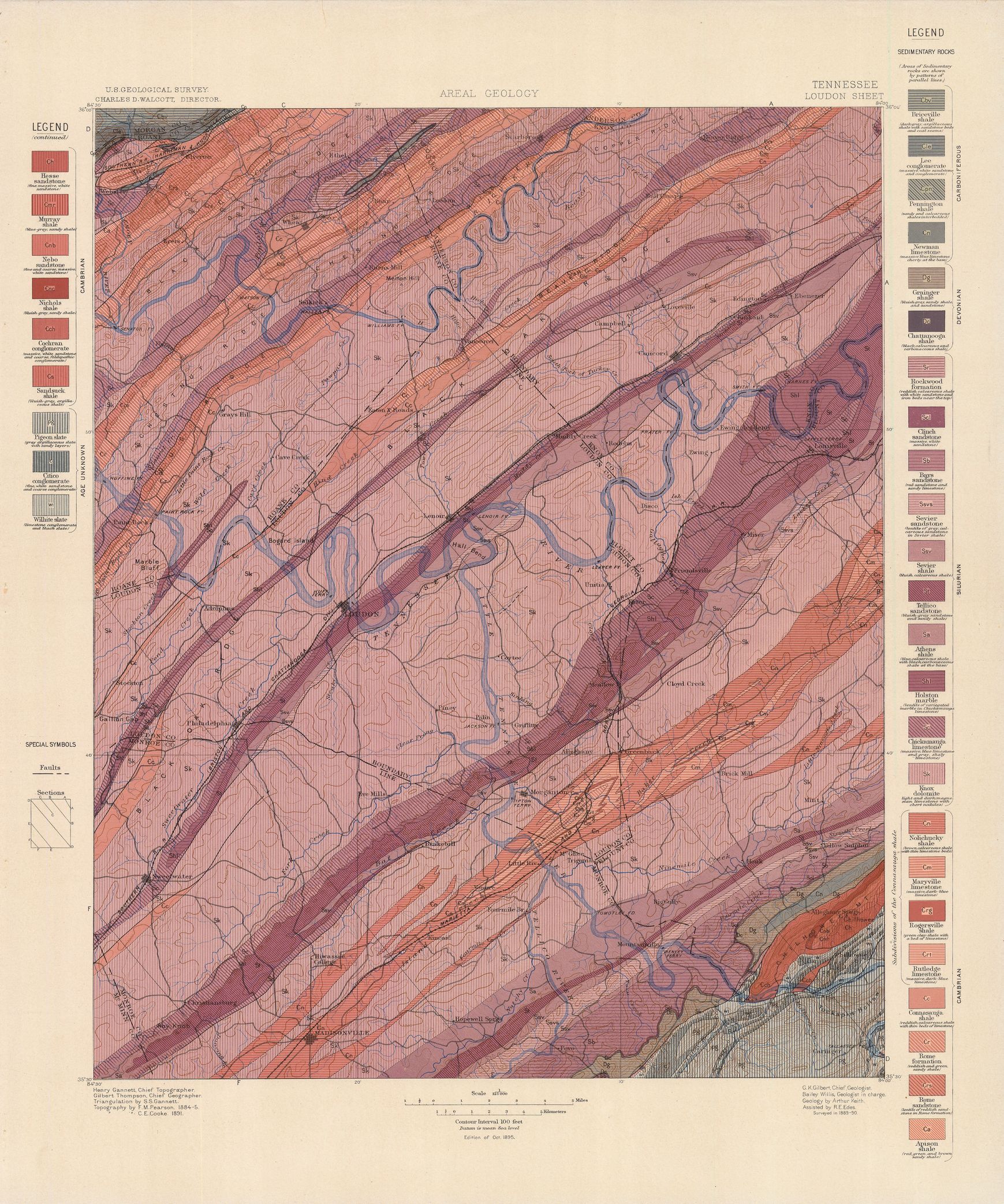
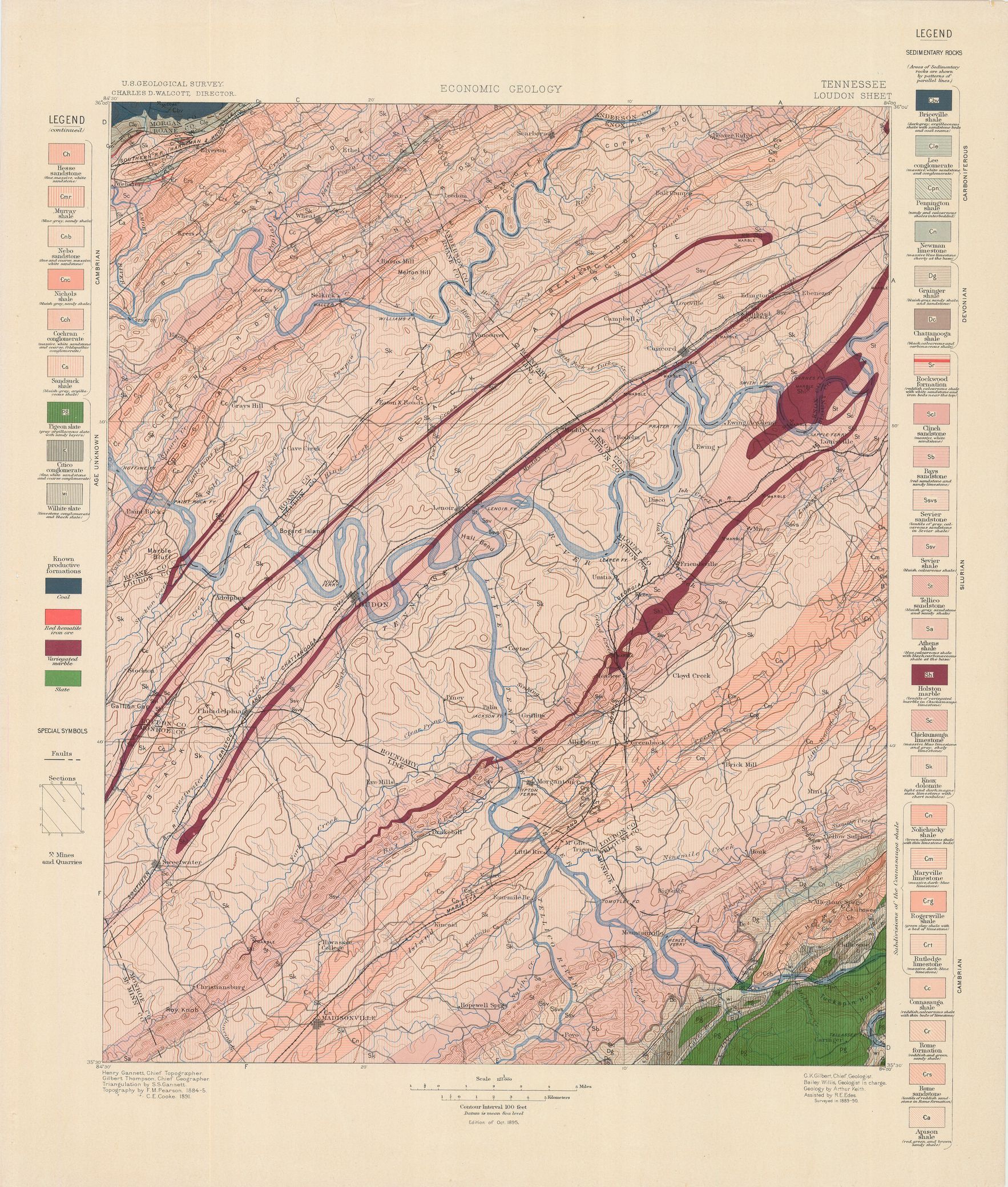
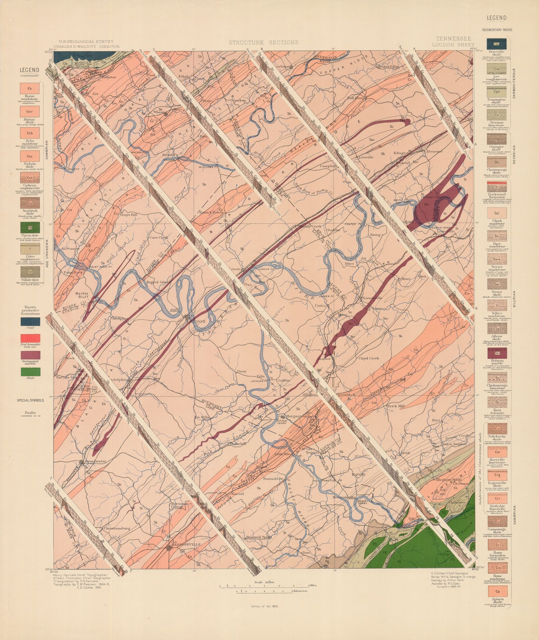
| dc.coverage.spatial | Tennessee | en |
| dc.creator | Keith, Arthur. | |
| dc.date.accessioned | 2006-04-04T18:46:01Z | |
| dc.date.accessioned | 2012-06-02T06:41:16Z | |
| dc.date.available | 2006-04-04T18:46:01Z | |
| dc.date.available | 2012-06-02T06:41:16Z | |
| dc.date.issued | 1896 | |
| dc.identifier.govdoc | I19.5/1:25 | |
| dc.identifier.uri | https://hdl.handle.net/1969.1/3026 | |
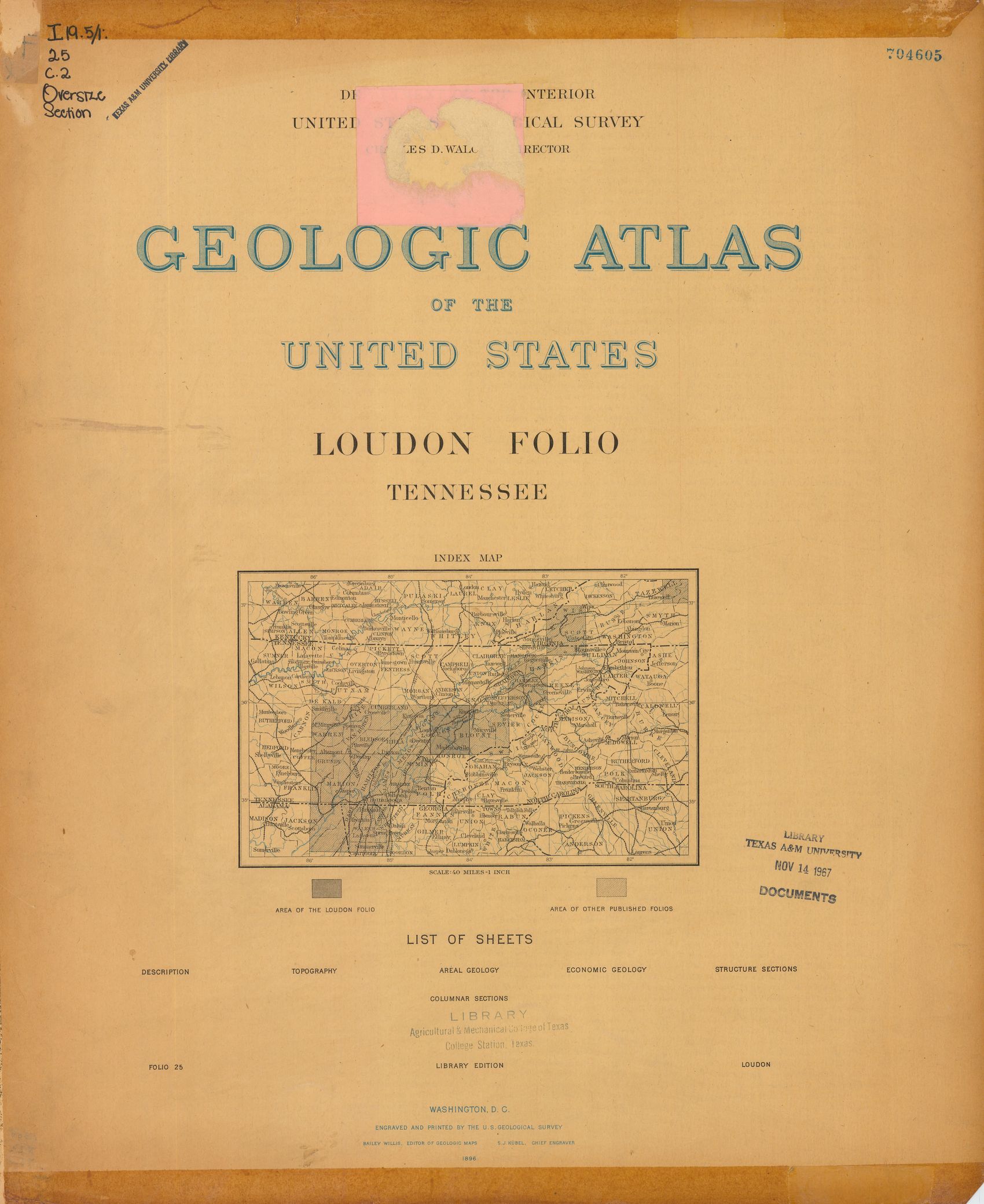
| dc.description | Loudon folio, Tennessee | en |
| dc.format.extent | 106368116 bytes | en |
| dc.format.extent | 106952936 bytes | en |
| dc.format.extent | 107052412 bytes | en |
| dc.format.extent | 107930500 bytes | en |
| dc.format.extent | 107333732 bytes | en |
| dc.format.extent | 107208576 bytes | en |
| dc.format.extent | 78906259 bytes | en |
| dc.format.extent | 106264116 bytes | en |
| dc.format.extent | 107575776 bytes | en |
| dc.format.extent | 107997320 bytes | en |
| dc.format.extent | 107202284 bytes | en |
| dc.format.extent | 103541932 bytes | en |
| dc.format.extent | 107239236 bytes | en |
| dc.format.extent | 106845852 bytes | en |
| dc.format.extent | 107544656 bytes | en |
| dc.format.mimetype | application/pdf | |
| dc.format.mimetype | image/tiff | |
| dc.format.mimetype | image/tiff | |
| dc.format.mimetype | image/tiff | |
| dc.format.mimetype | image/tiff | |
| dc.format.mimetype | image/tiff | |
| dc.format.mimetype | image/tiff | |
| dc.format.mimetype | image/tiff | |
| dc.format.mimetype | image/tiff | |
| dc.format.mimetype | image/tiff | |
| dc.format.mimetype | image/tiff | |
| dc.format.mimetype | image/tiff | |
| dc.format.mimetype | image/tiff | |
| dc.format.mimetype | image/tiff | |
| dc.format.mimetype | image/tiff | |
| dc.language.iso | en_US | |
| dc.publisher | Geological Survey (United States) | |
| dc.relation.ispartofseries | Geologic Atlas of the United States | |
| dc.relation.ispartofseries | 25 | |
| dc.rights | No copyright; for more information see: https://rightsstatements.org/page/NoC-US/1.0/ | en |
| dc.rights.uri | https://rightsstatements.org/page/NoC-US/1.0/ | |
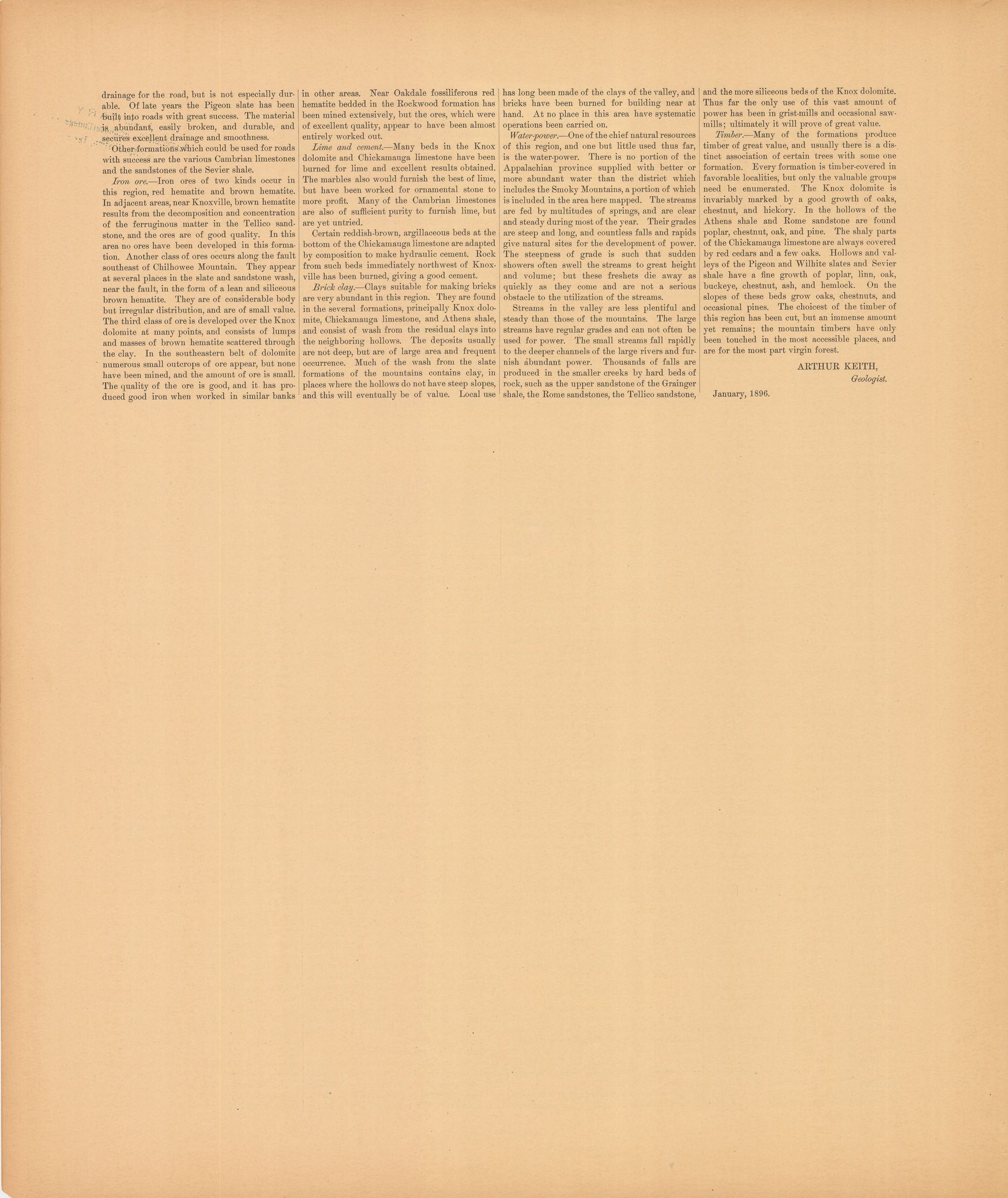
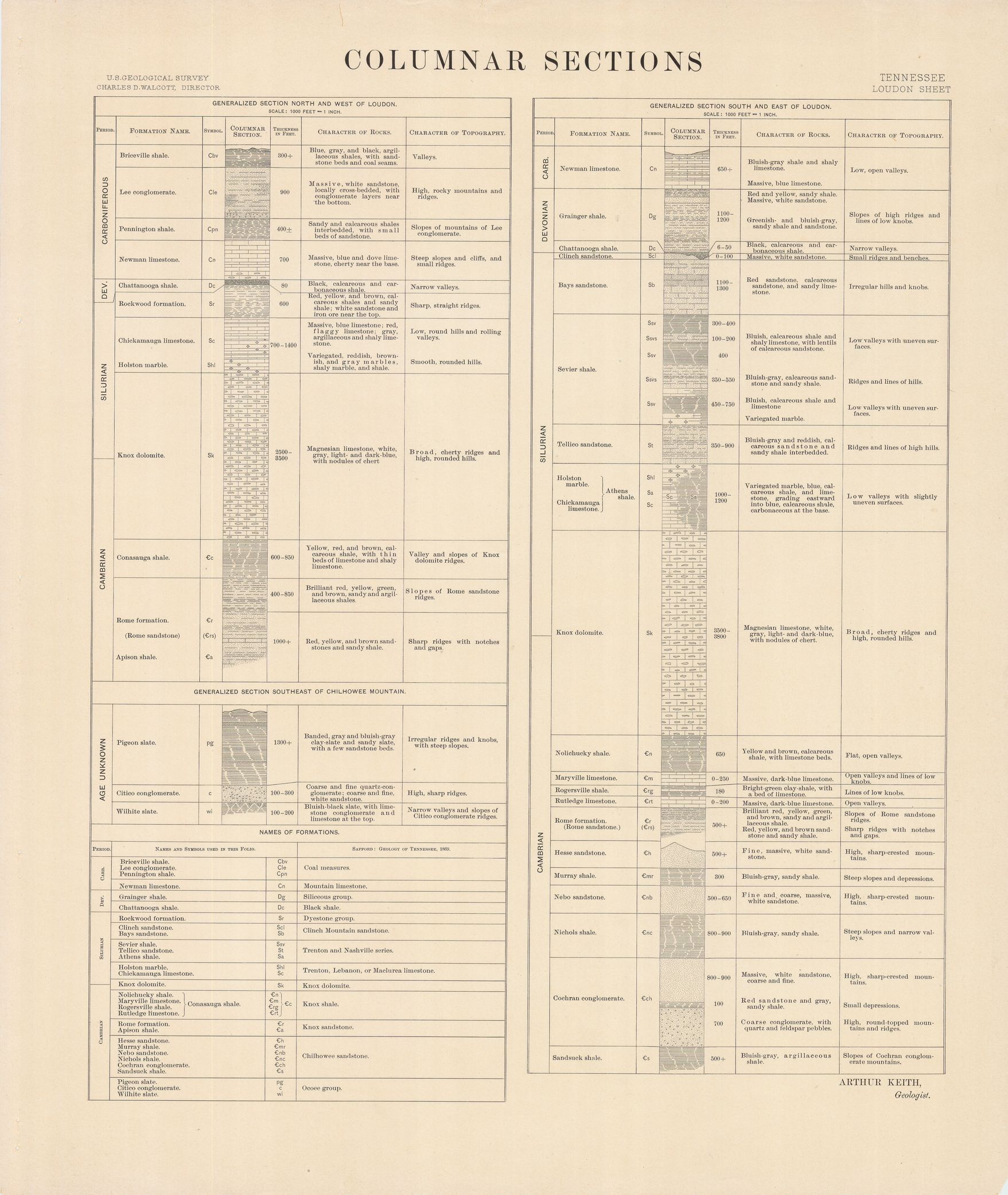
| dc.subject | Cambrian - Nolichucky shale; Maryville limestone; Rogersville shale; Rutledge limestone; Connasauga shale; Rome formation; Rome sandstone; Apison shale | en |
| dc.subject | Silurian - Rockwood formation; Clinch sandstone; Bays sandstone; Sevier sandstone; Tellico sandstone; Athens shale; Holstone marble; Chickamauga limestone; Knox dolomite | en |
| dc.subject | Devonian - Grainger shale; Chattanooga shale | en |
| dc.subject | Carboniferous - Briceville shale; Lee conglomerate; Pennington shale; Newman limestone | en |
| dc.subject | Cambrian - Hesse sandstone; Murray shale; Nebo sandstone; Nichols shale; Cochran conglomerate; Sandsuck shale | en |
| dc.subject | Proterozoic - Pigeon slate; Citico conglomerate; Wilhite slate | en |
| dc.subject.lcsh | Geology--Tennessee--Maps | en |
| dc.subject.lcsh | Geology -- United States --Maps | en |
| dc.title | Loudon folio, Tennessee | en |
| dc.type | Book | en |
| dc.type | Image | en |
| dc.type | Map | en |
| dc.coverage.box | northlimit=36; westlimit=-84.5; southlimit=35.5; eastlimit=-84 | en |
| dc.coverage.point | 35:30:00N84:00:00W | en |