| dc.creator | Hayes, C. W. (Charles Willard), 1859-1916. | |
| dc.date.accessioned | 2006-03-31T16:00:21Z | |
| dc.date.accessioned | 2012-06-02T02:36:21Z | |
| dc.date.available | 2006-03-31T16:00:21Z | |
| dc.date.available | 2012-06-02T02:36:21Z | |
| dc.date.issued | 1894 | |
| dc.identifier.govdoc | I19.5/1:6 | |
| dc.identifier.uri | https://hdl.handle.net/1969.1/3007 | |
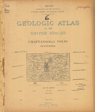
| dc.description | Chattanooga folio, Tennessee | en |
| dc.format.extent | 108985148 bytes | en |
| dc.format.extent | 108951288 bytes | en |
| dc.format.extent | 107130120 bytes | en |
| dc.format.extent | 108043412 bytes | en |
| dc.format.extent | 107086932 bytes | en |
| dc.format.extent | 107637296 bytes | en |
| dc.format.extent | 109123144 bytes | en |
| dc.format.extent | 107093556 bytes | en |
| dc.format.extent | 59980873 bytes | en |
| dc.format.extent | 108937316 bytes | en |
| dc.format.extent | 107416008 bytes | en |
| dc.format.extent | 106918472 bytes | en |
| dc.format.mimetype | image/tiff | |
| dc.format.mimetype | image/tiff | |
| dc.format.mimetype | image/tiff | |
| dc.format.mimetype | image/tiff | |
| dc.format.mimetype | image/tiff | |
| dc.format.mimetype | image/tiff | |
| dc.format.mimetype | image/tiff | |
| dc.format.mimetype | application/pdf | |
| dc.format.mimetype | image/tiff | |
| dc.format.mimetype | image/tiff | |
| dc.format.mimetype | image/tiff | |
| dc.format.mimetype | image/tiff | |
| dc.language.iso | en_US | |
| dc.publisher | Geological Survey (United States) | |
| dc.relation.ispartofseries | 6 | |
| dc.relation.ispartofseries | Geologic Atlas of the United States | |
| dc.rights | No copyright; for more information see: https://rightsstatements.org/page/NoC-US/1.0/ | en |
| dc.rights.uri | https://rightsstatements.org/page/NoC-US/1.0/ | |
| dc.subject | Carboniferous - Walden sandstone; Lookout sandstone; Bangor limestone; Floyd shale; Fort Payne chert | en |
| dc.subject | Devonian - Chattanooga black shale | en |
| dc.subject | Cambrian - Connasauga shale; Rome formation; Apison shale | en |
| dc.subject | Silurian - Rockwood formation; Chickamauga limestone; Knox dolomite | en |
| dc.subject.lcsh | Geology -- Tennessee -- Rhea County -- Maps | en |
| dc.subject.lcsh | Geology -- United States --Maps | en |
| dc.subject.lcsh | Geology -- Tennessee -- Bradley County -- Maps | en |
| dc.subject.lcsh | Geology -- Tennessee -- Sequatchie County -- Maps | en |
| dc.subject.lcsh | Geology -- Tennessee -- Marion County -- Maps | en |
| dc.subject.lcsh | Geology -- Tennessee -- Bledsoe County -- Maps | en |
| dc.subject.lcsh | Geology -- Tennessee -- Hamilton County -- Maps | en |
| dc.title | Chattanooga folio, Tennessee | en |
| dc.type | Book | en |
| dc.type | Map | en |
| dc.type | Image | en |
| dc.coverage.box | northlimit=35.5; westlimit=-85.5; southlimit=35; eastlimit=-85 | en |
| dc.coverage.point | 35:00:00N85:00:00W | en |