| dc.coverage.spatial | Montana | en |
| dc.creator | Weed, Walter Harvey, 1862-1944. | |
| dc.date.accessioned | 2005-12-12T19:31:32Z | |
| dc.date.accessioned | 2012-06-01T23:36:35Z | |
| dc.date.available | 2005-12-12T19:31:32Z | |
| dc.date.available | 2012-06-01T23:36:35Z | |
| dc.date.issued | 1899 | |
| dc.identifier.govdoc | I19.5/1:56 | |
| dc.identifier.uri | https://hdl.handle.net/1969.1/2824 | |
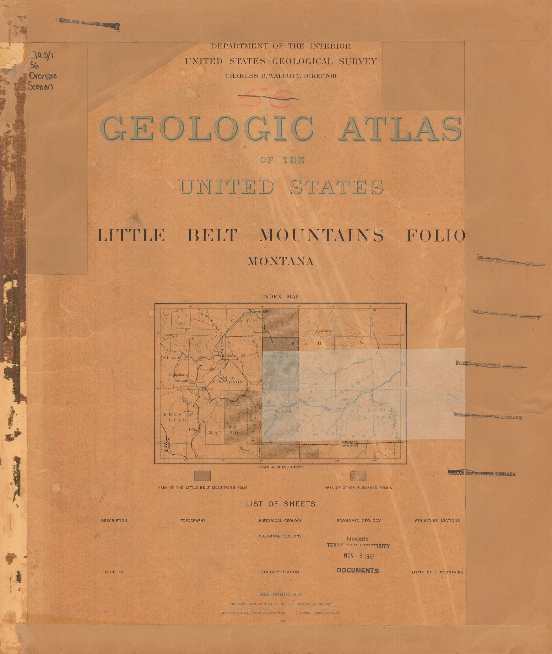
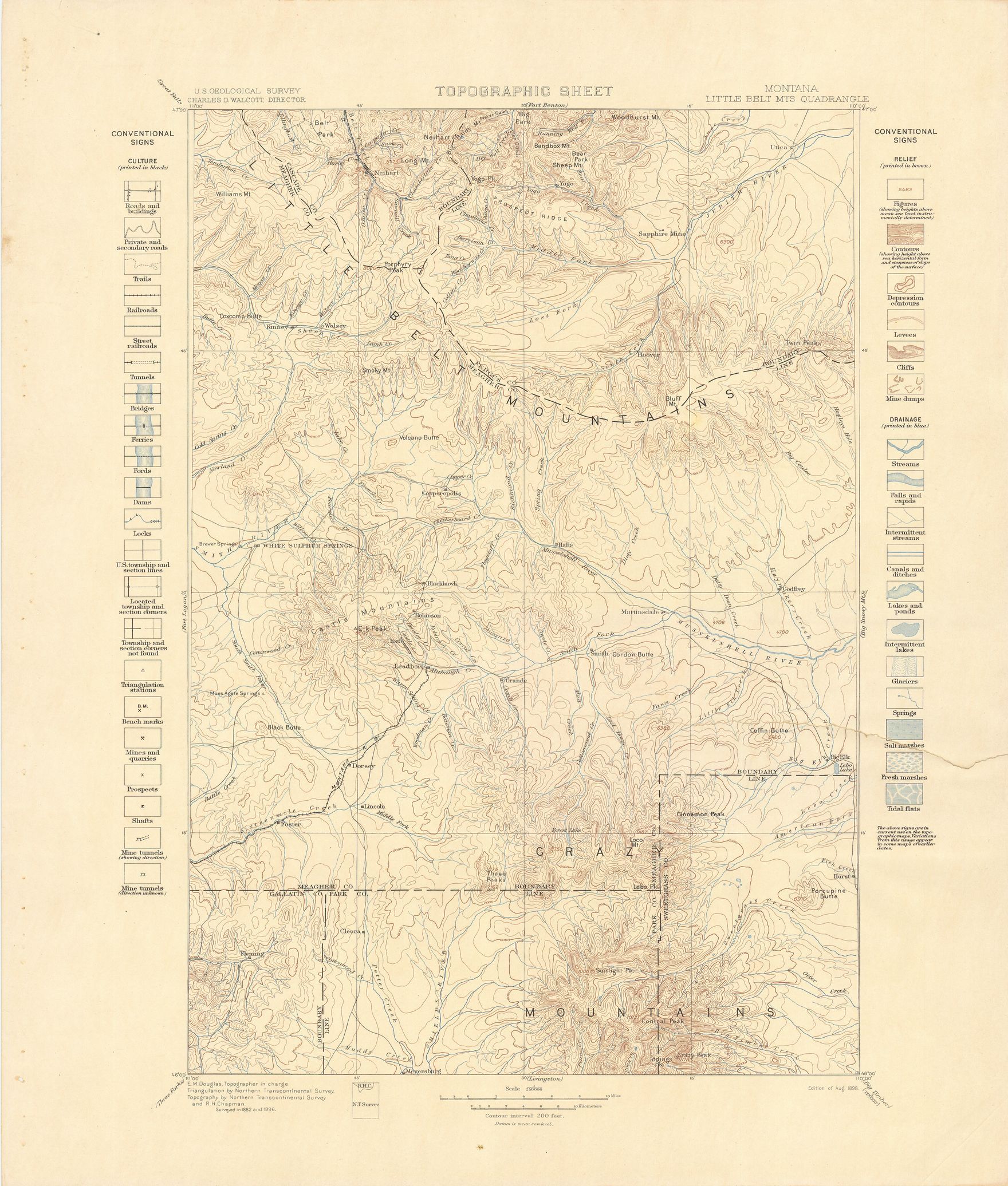
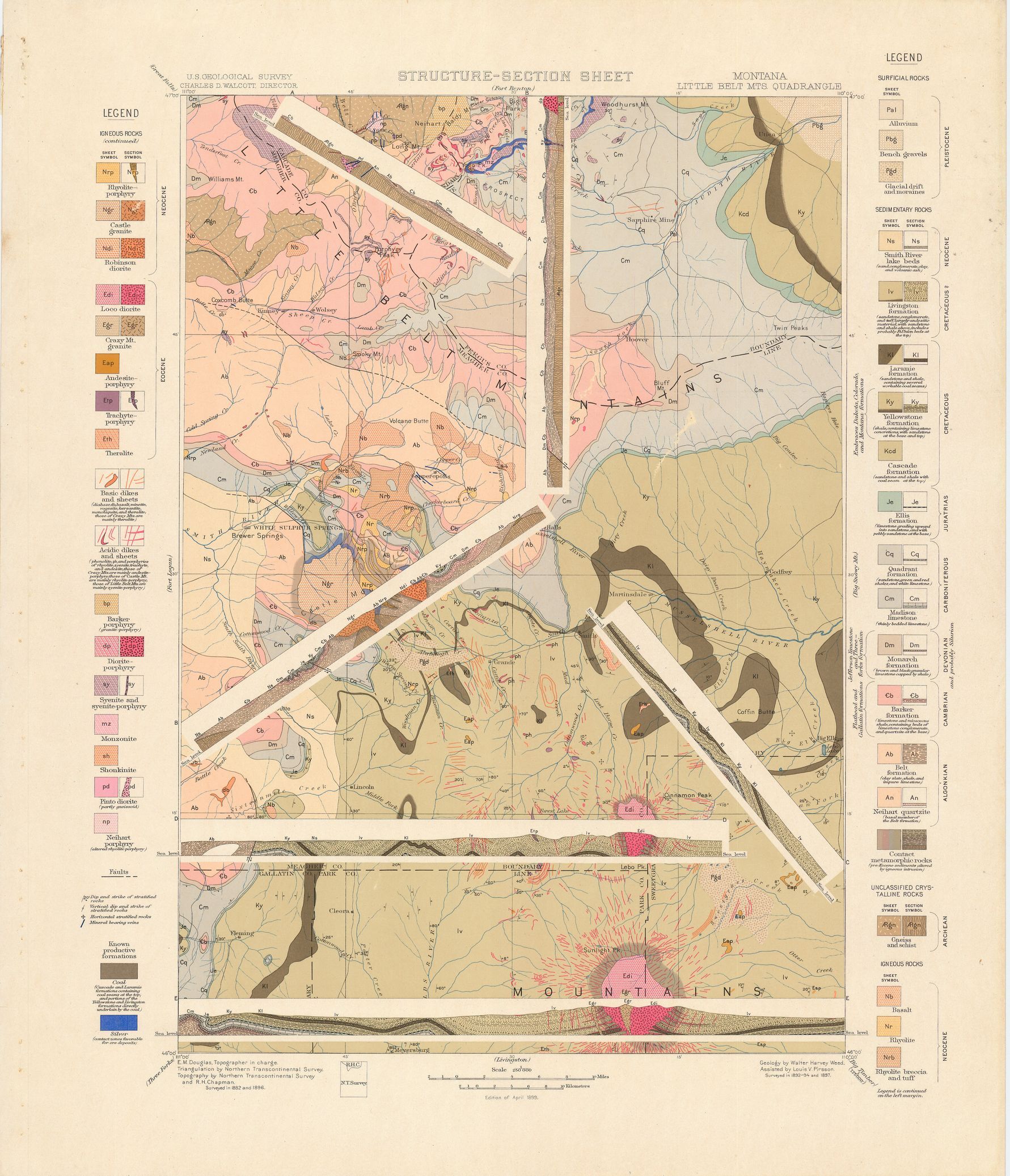
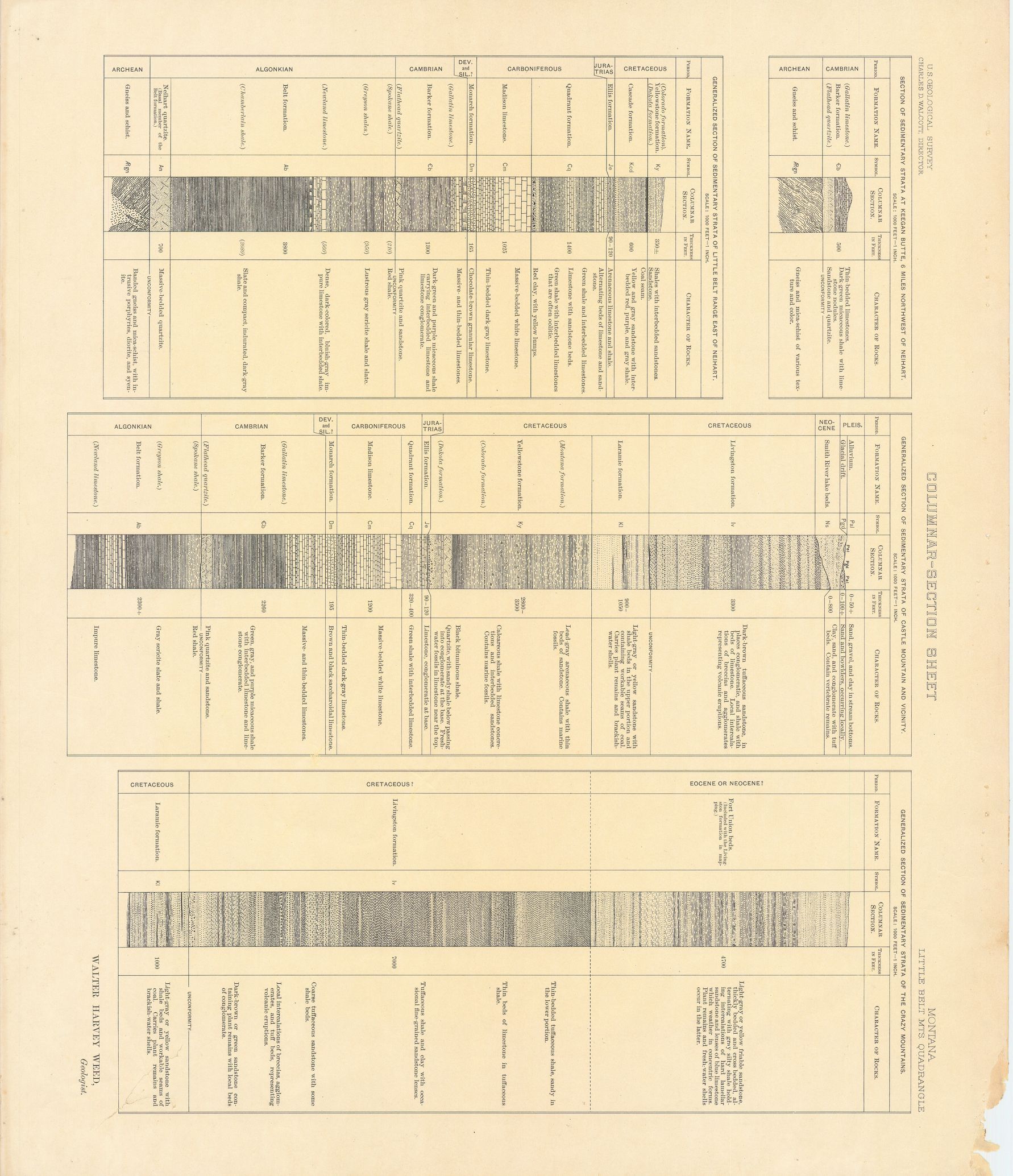
| dc.description | Little Belt Mountains folio, Montana | en |
| dc.format.extent | 106580536 bytes | en |
| dc.format.extent | 26653365 bytes | en |
| dc.format.extent | 106170388 bytes | en |
| dc.format.extent | 106362328 bytes | en |
| dc.format.extent | 106404512 bytes | en |
| dc.format.extent | 106852272 bytes | en |
| dc.format.extent | 108171324 bytes | en |
| dc.format.extent | 108238208 bytes | en |
| dc.format.extent | 108461976 bytes | en |
| dc.format.extent | 105833724 bytes | en |
| dc.format.extent | 106036816 bytes | en |
| dc.format.extent | 107958632 bytes | en |
| dc.format.extent | 104154304 bytes | en |
| dc.format.extent | 105887212 bytes | en |
| dc.format.extent | 105902480 bytes | en |
| dc.format.extent | 106486928 bytes | en |
| dc.format.extent | 107847008 bytes | en |
| dc.format.extent | 107326284 bytes | en |
| dc.format.mimetype | image/tiff | |
| dc.format.mimetype | image/tiff | |
| dc.format.mimetype | image/tiff | |
| dc.format.mimetype | image/tiff | |
| dc.format.mimetype | image/tiff | |
| dc.format.mimetype | image/tiff | |
| dc.format.mimetype | image/tiff | |
| dc.format.mimetype | image/tiff | |
| dc.format.mimetype | image/tiff | |
| dc.format.mimetype | image/tiff | |
| dc.format.mimetype | image/tiff | |
| dc.format.mimetype | image/tiff | |
| dc.format.mimetype | image/tiff | |
| dc.format.mimetype | application/pdf | |
| dc.format.mimetype | image/tiff | |
| dc.format.mimetype | image/tiff | |
| dc.format.mimetype | image/tiff | |
| dc.format.mimetype | image/tiff | |
| dc.language.iso | en_US | |
| dc.publisher | Geological Survey (United States) | |
| dc.relation.ispartofseries | 56 | |
| dc.relation.ispartofseries | Geologic Atlas of the United States | |
| dc.rights | No copyright; for more information see: https://rightsstatements.org/page/NoC-US/1.0/ | en |
| dc.rights.uri | https://rightsstatements.org/page/NoC-US/1.0/ | |
| dc.subject | Paleogene - Loco diorite; Crazy Mt. granite | en |
| dc.subject | Neogene - Castle granite; Robinson diorite; Smith River lake beds | en |
| dc.subject | Carboniferous - Quadrant formation; Madison limestone | en |
| dc.subject | Age/Period unspecified - Barker poryphyry; Pinto diorite; Heihart porphyry | en |
| dc.subject | Devonian - Monarch formation | en |
| dc.subject | Triassic - Ellis formation | en |
| dc.subject | Jurassic - Ellis formation | en |
| dc.subject | Cretaceous - Livingston formation; Laramie formation; Yellowstone formation; Cascade formation | en |
| dc.subject | Archean - unnamed strata | en |
| dc.subject | Proterozoic - Belt formation; Neihart quartzite | en |
| dc.subject | Cambrian - Barker formation | en |
| dc.subject.lcsh | Geology -- United States --Maps | en |
| dc.subject.lcsh | Geology--Montana--Maps | en |
| dc.title | Little Belt Mountains folio, Montana | en |
| dc.type | Image | en |
| dc.type | Map | en |
| dc.type | Book | en |
| dc.coverage.box | northlimit=47; westlimit=-111; southlimit=46; eastlimit=-110 | en |
| dc.coverage.point | 46:00:00N110:00:00W | en |