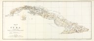
Map of Cuba Compiled from Chart E U.S. Coast and Geodetic Survey
Date
1990Metadata
Show full item recordDescription
21 x 9 inch map taken from: Report on the census of Cuba, 1899 (Book) 786 p. front. (port.) plates, maps, diagrs. 24cm.Collections
Citation
(1990). Map of Cuba Compiled from Chart E U.S. Coast and Geodetic Survey. U.S. War Dept. Cuban census office. Available electronically from https : / /hdl .handle .net /1969 .1 /147610.